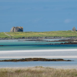
Vallay
Share via...
57.661747, -7.405838
About Us

Hi and welcome to Islandeering Islandeering is for people who want adventure in Britain’s wild blue spaces – our rivers, coast, lakes, canals and islands. You will find amazing walks, paddles and swims in the UK’s most special places, those recognised for outstanding natural beauty, incredible geology or special and abundant wildlife.
Learn More
Learn More
Distance: 15.7 km
Difficulty: Easy
Method: Walking
Wow Factor: 10 out of 10
Key Facts
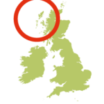
- Location: Off North Uist, Outer Hebrides
- Size: 260 hectares
- Terrain: Tidal sands; grassy foreshore and dune tracks
- Access: Tidal sands
- Height gain: 251 metres
- Map: OS Explorer 454
- Starting point: Pull-in at Aird Glas Lat/Long 57.6361, -7.3972; GR NF 780 735
- Accommodation/food:
There are no facilities on the island. Our favourite pub in the Outer Hebrides, the Westford Inn, can be found nearby on North Uist. For nearby accommodation, with views of the island, there are luxury tree houses and forest cabins at Uist Forest Retreat
- Island Summary:
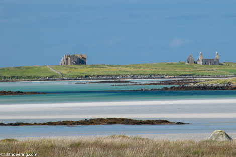
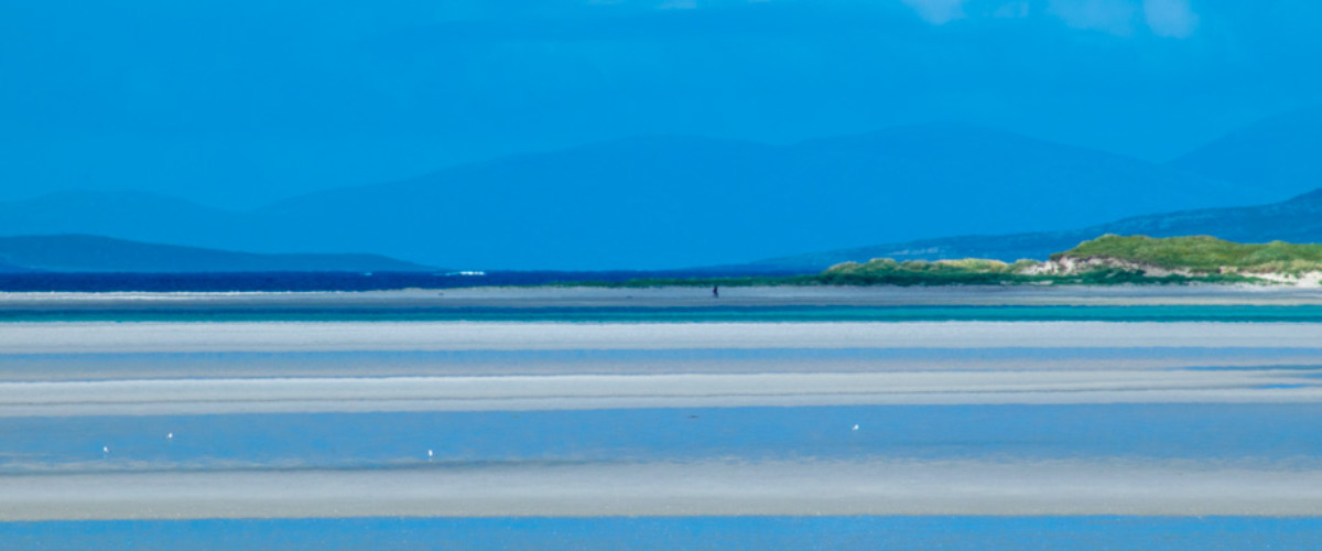
Vallay sits off the northwest coast of North Uist in the Outer Hebrides. It was first settled in Neolithic times and inhabited until the middle of last century so there are plenty of ruins to discover. To the south is a sheltered lagoon, to the north are wild Atlantic beaches with views extending to St Kilda and Harris. This is definitely a coastline of contrasts. Inland, horned Highland cattle bring to mind the Vikings that once invaded these shores. Vallay is a remote and secret destination for nature lovers and pioneering outdoor enthusiasts – walkers, swimmers, surfers, kite-surfers, and windsurfers – although you’ll rarely see another soul.
- Look out for:
- Deserted white-shell beaches for swimming or surfing
- Panoramic views to distant St Kilda
- Wild camping or marooning yourself to spend more time here
- Surprising an otter who rarely sees any visitors
- Epic crossing over vast tidal sands
- Extraordinary machair with abundant wild flowers and wildlife
- Route description:
The walk starts with an epic three-kilometre crossing of vast, tidal Traigh Bhalaigh – Vallay Strand. Once on the island, the free-range route follows animal tracks through the machair alongside the sandy foreshore of the south and east, before continuing on an undulating path over the dunes that back the white crescent beaches of the north coast. Download our free route guide for more information
- Getting there:
Drive west from Sollas on the A865 and about 2.5km beyond Malacleit find Aird Glas, opposite a forestry plantation, with parking space for 2 cars to the side of the track. Cross Vallay Strand and head towards the mansion
Island routes nearby:
Walk to North Uist’s high point
Walk to South Uist’s high point
Join our Islandeering community
We continuously find new islands, rivers, lochs, canals and coast to walk, SUP and swim in and meet plenty of great folks along the way. Join our community to get new routes and adventures, latest blogs and news by using the email box below. Tune in also to our Facebook and Instagram pages to see where we are going next.

Share via...
Gallery