Walk St Cuthbert's Way Across to Holy Island
Follow in the footsteps of ancient pilgrims across the tidal sands
Learn More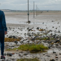

Follow in the footsteps of ancient pilgrims across the tidal sands
Learn More

There is a range of Holy Island accommodation in the main village. Also, cafes, restaurants and pubs to choose from. Our favourite for great coffee is the Pilgrim’s Coffee House.
Follow in the footsteps of ancient pilgrims and race the tides to soak up the spiritual vibe of Holy Island. Described as the cradle of Christianity in England it was the chosen site for the mission of converting pagans to Christians and transforming a nation. This route passes Lindisfarne Castle, the Gertrude Jeckyll Garden and Lindisfarne Priory and walks through Lindisfarne National Nature Reserve with the addition of a walk alongside the tidal causeway and the length of the wild, windswept and rarely visited north coast.
The circular route around Holy Island Lindisfarne starts at the island’s car park, then immediately heads north along the causeway to circumnavigate the dunes at Snook Point. The energising section along the windswept beaches of the north of the island leads to a myriad of sandy paths that undulate through the dunes of The Link to access the easy-graded path around the rockier-east coast. Some straightforward route finding will be needed at the south-west tip of the island to reach the beach at The Basin before a steep climb up the bank to find the narrow, low cliff-top path leading back to the main car-park. See map below.
By cycle; NCN1. Coast and Castles cycle route.
On foot; from main Holy Island village
By train; Berwick-upon-Tweed 10 miles from causeway
By road; 5 miles east of A1 across a tidal causeway, please check safe crossing times before visiting by going to http://www.northumberland.gov.uk/default.aspx?page=3309
Parking: in the interests of village residents please use main island car park, 1 mile (signposted before village). Pay and display.
By bus; 477 service from Berwick-upon-Tweed train station, with connecting buses at Beal to and from Newcastle. Times vary with season and tides. Also private island minibus from Holy Island car park to castle
We continuously find new islands, rivers, lochs, canals and coast to walk, SUP and swim in and meet plenty of great folks along the way. Join our community to get new routes and adventures, latest blogs and news by using the email box below. Tune in also to our Facebook and Instagram pages to see where we are going next.

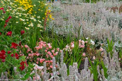
Colourful and fragrant blooms in the Gertrude Jekyll Garden
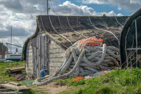
Upturned boats re-used as sheds on The Ouse
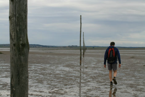
This is a must. Arrive on the Holy Island in the footsteps of the pilgrims and walk along St Cuthbert’s Way. The poles show the safe route and half-way across there’s a shelter to climb into if you get the tides wrong. It’s been used many a time!!
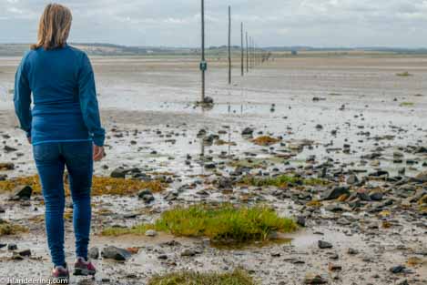
Walking to Lindisfarne on the Pilgrim's Way
