
54.066593, -3.196184
- Location: Barrow-in-Furness
- Terrain: Tidal sand and mud
- Access: Low tide walk
- Height gain: 34 metres
- Map: OS Explorer OL6
- Starting point: Snab Point, Walney Island (GR SD 209 639)
- Accommodation/food:
On Walney Island there is the excellent (and rustic) Queens Arms, Biggar for good food and great beer.
On Piel Island there is a great campsite and characterful The Ship Inn
- Activity Summary:
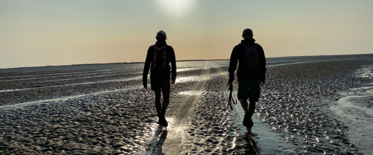
The walk between Walney Island and Piel Island is an unforgettable experience. The views throughout this walk are outstanding and reach to the peaks of the Lake District and the vast expanse of Morecambe Bay, as well as the industrial landscape of Barrow-in-Furness.
NOTE: The water recedes so far during low tide that it almost completely disappears over the horizon – but when it comes in it comes in quickly and so you need to have a very good understanding of the tide times for Walney Island and this walk should only be attempted 2 hours either side of low tide (and preferably start the walk on an outgoing tide). Cars drive between the islands and you might be lucky to simply follow their tyre prints, otherwise roughly follow the route in this post to avoid sticky mud and the deeper channels. That said, it is possible that the routes shift between seasons, so always get local advice first or join one of the organised walks to Piel Island.
- Look out for:
- Sand and mud sculpted by the tides
- Piel Island's own royal family
- Route description:
The walk to Piel Island from Walney Island starts at Snab Point on Walney and heads out on an initially obvious NE route, passing to the north of Sheep Island. Continue on this rough bearing for 2.2 km, then head SW (walking parallel to the main Piel Channel on your left) towards the ramp on to the island. Return the same route.
Once on the island it is possible to walk around the whole island along its coast path and explore the castle
- Getting there:
From Barrow-in-Furness follow signs for Walney Island. Cross Jubilee Bridge onto the Island and follow brown signs left at traffic lights. Follow this road for about 1 km then turn left down Carr Lane. Pass Biggar Village, follow the brown campsite signs, and continue for 3.2 km to reach the pull-in on your left at Snab Point (where there is a yellow post and marker)
