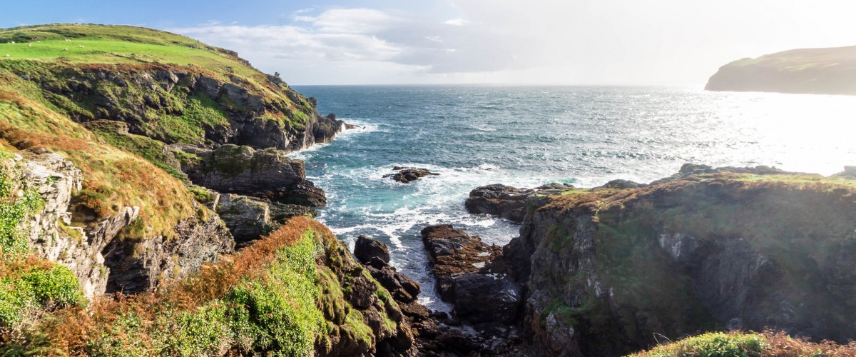
The Raad ny Foillan, Manx for ‘The Way of the Gull’, is a 157-kilometre coastal path around the whole island. Starting in Douglas, the southern section runs along clifftop paths lined with heather and dwarf gorse, past the tidal races of Calf Sound, which separates the Calf of Man from the main island. North of Port Erin the route heads along the high cliffs, including The Stacks, and climbs three summits, the highest of which, at 437 metres, is Cronk ny Arrey Laa. The route continues through Peel with its castle, moves slightly inland to follow an old railway track, then returns to the coast again to reach the shingle beaches and lighthouse at Point of Ayre in the north. From here the trail heads south along the more populated east coast, exploring some beautiful glens and coastal villages including Laxey, before reaching the promenades of Douglas. In addition to the Raad ny Foillan there are two further long-distance paths across the hills and moors of the island’s interior: the Millennium Way stretches for thirty-six kilometres from Ramsey to Castletown while the Herring Road runs for twenty-four kilometres from Peel to Castletown. Photo credit: “Isle of man coast” by Steven William Alexander is marked with Public Domain Mark 1.0.
Discover more island adventures on over 300 islands in England Wales in our book Island bagging England and Wales