Herm Island, Guernsey

About Us

Hi and welcome to Islandeering Islandeering is for people who want adventure in Britain’s wild blue spaces – our rivers, coast, lakes, canals and islands. You will find amazing walks, paddles and swims in the UK’s most special places, those recognised for outstanding natural beauty, incredible geology or special and abundant wildlife.
Learn More

Join our Islandeering community

We continuously find new islands, rivers, lochs, canals and coast to walk, SUP and swim in and meet plenty of great folks along the way. Join our community to get new routes and adventures, latest blogs and news by using the email box below. Tune in also to our Facebook and Instagram pages to see where we are going next.
High Point: 65 metres
Population: 60
Size: 199 ha
Wild Factor: 6 out of 10

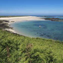
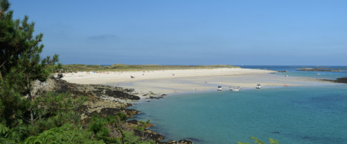
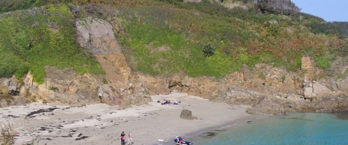
Overview of Herm: The smallest of the publicly accessible Channel Islands, only 5 kilometres east of Guernsey, is a popular destination with six astounding beaches and with no cars, radios, clocks or TV’s permitted on the island it is a perfect place to relax. Its history stretches back to monks, smugglers, quarrymen, Prussian Princesses and occupying Germans, all who have left their mark. With fabulous dunes, white sand beaches, a large flower-filled common, Neolithic tombs, wild cliff paths and winding inland lanes there is plenty to explore. Owned by the States of Guernsey its current tenants aim to retain the identity of the island whilst keeping it open for the enjoyment of all.

Type of island: inhabited

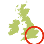
Location: Bailiwick of Guernsey, Channel Islands

Herm’s highpoint 65 metres (WV 400 796)

How to get to Herm: A frequent, seasonal boat service, Travel Trident,  leaves from near the Weighbridge Clock Tower, St Peter Port for the 20 minute trip to Herm.

Getting around Herm: with no cars on Herm the only way to get around is walking

Best time to go to Herm: the best months for good weather in Jersey are June, July, August, September and October with the warmest months being July, August and September. The coldest months are January and February and the rainiest are January, October, November and December. The best months for swimming are August and September

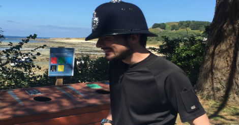
Dog friendly: Herm is a dog friendly destination. No doggy passport required and plenty of dog-friendly accommodation although they are not permitted on the beaches beaches between 1 May and 30 September at any time, including Shell Beach, Belvoir Bay, Fisherman’s Beach and the stretch of beach in front of the White House Hotel to the Harbour jetty.

Food and drink on Herm: there are a number of eating and drinking options on Herm including the more upmarket White House Hotel. Food is also available at The Ship Inn, The Mermaid Tavern, and a couple of Beach Cafés.

Accommodation on Herm: Herm Island has a range of self-catering accommodation. Herm Island Campsite offers fully equipped camping or you can take your own tent and a range of holiday cottages is also available. The beautifully located Whitehouse Hotel is the only hotel on the island.

Contacts:  Visit Herm, tel. 01481 750000 or email reservations@herm.com

Photo copyright Colin Smith

  • Look out for:
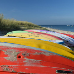
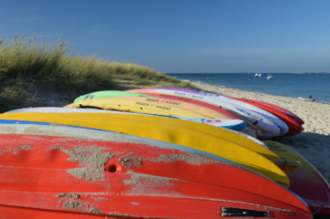
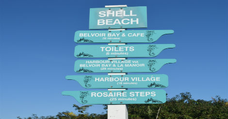
    • Swimming from Shell Beach
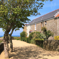
    • Idyllic lanes leading to Manor Village
    • Camping under the stars
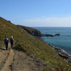
    • Walk the coast path

Spot puffins on Herm

Discover Herm's puffins and other outdoor activities on Herm

Learn More

Swimming on Herm

Find the best beach on Herm

Learn More

Manor Village & St Tugual Chapel

Explore idyllic lanes, stone hamlet and Chapel

Learn More

Walk Herm's coastal path

Walk the beautiful Herm coastline

Learn More

Herm Camping

Island hotels, island campsites and more

Learn More
Herm Island, Guernsey

About Us

Hi and welcome to Islandeering Islandeering is for people who want adventure in Britain’s wild blue spaces – our rivers, coast, lakes, canals and islands. You will find amazing walks, paddles and swims in the UK’s most special places, those recognised for outstanding natural beauty, incredible geology or special and abundant wildlife.
Learn More

Join our Islandeering community

We continuously find new islands, rivers, lochs, canals and coast to walk, SUP and swim in and meet plenty of great folks along the way. Join our community to get new routes and adventures, latest blogs and news by using the email box below. Tune in also to our Facebook and Instagram pages to see where we are going next.
Distance: 6.4 km
Difficulty: Easy
Method: Walking
Wow Factor: 8 out of 10

Key Facts

  • Location: Channel Islands
  • Size: 200 hectares
  • Terrain: Easy terrain coastal path
  • Access: Trident ferry from Guernsey
  • Height gain: 147 metres
  • Map: Bailiwick of Guernsey: States of Guernsey Official Map Starting point Herm quay near Ship Hotel
  • Accommodation/food:

    Mermaid Tavern, Ship Inn and White House Hotel; and the Seagull campsite

  • Island Summary:

    Herm has it all really. It’s easy to get to, has a couple of astoundingly beautiful beaches and is surrounded by crystal clear waters that almost disappear at low tide to reveal the vast expanse of rocky reefs that protect it. This comes packaged with all of the creature comforts you are likely to need with a pub, two cafes and a hotel and a restaurant or two. Not bad for only being one and a half miles long and half a mile wide.

  • Look out for:
    • Swimming opportunities at Shell Beach and Belvoir Beach
  • Route description:

    This civilised two-hour round island route is like a walk in the park (with a bit of hill climbing). It’s easy and enjoyable with plenty of café stops on the way yet the diversity of this small island will surprise you at every turn. The rugged south-coast cliffs give way to the fabulous sandy beaches and dunes of the east. The west coast reveals the best of the colour and bustle of St Peter Port over the water. And then to finish? An indulgent stop off in the friendly Mermaid Tavern for a swift one or two.

  • Getting there:

    The scheduled Trident ferry service from St Peter Port, Guernsey.

List   

Information
Click following button or element on the map to see information about it.
Lf Hiker | E.Pointal contributor

NO NAMED GPX   

Profile

50 100 150 200 5 10 15 Distance (km) Elevation (m)
No data elevation
Name: No data
Distance: No data
Minimum elevation: No data
Maximum elevation: No data
Elevation gain: No data
Elevation loss: No data
Duration: No data

Description

Herm

Gallery