No activities have been added for this island yet.
Kerrera
Share via...
56.404137, -5.532245
About Us

Hi and welcome to Islandeering Islandeering is for people who want adventure in Britain’s wild blue spaces – our rivers, coast, lakes, canals and islands. You will find amazing walks, paddles and swims in the UK’s most special places, those recognised for outstanding natural beauty, incredible geology or special and abundant wildlife.
Learn More
Learn More
Distance: 22.7 km
Difficulty: Moderate
Method: Walking
Wow Factor: 7 out of 10
Key Facts
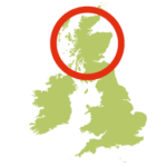
- Location: Inner Hebrides, near Oban
- Size: 1214 hectares
- Terrain: Easy tracks; free range on grassy raised beaches with some boggy areas; beach crossings
- Access: Ferry
- Height gain: 456 metres
- Map: OS Explorer 359
- Starting point: From Oban take the Gallanach ferry, just south of Oban; there is also a ferry offering a service to the north end of Kerrera that leaves from the North Pier in Oban
- Accommodation/food:
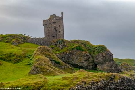
The Kerrera Teahouse near Gylan Castle offers snacks, toilets and a bunkhouse accommodation. Full range of facilities in nearby Oban.
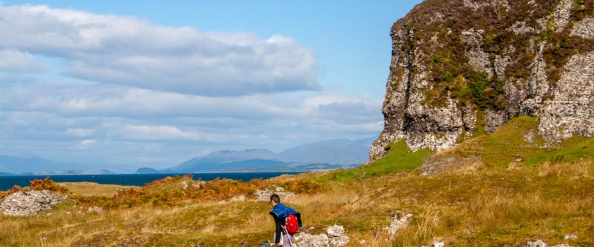
- Island Summary:
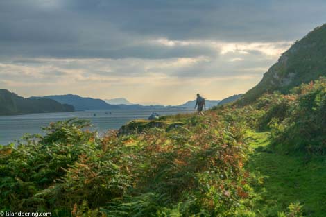
Kerrera forms a natural breakwater that sits just a few hundred metres away from the hustle and bustle of the harbour town of Oban. A stunning example of the effects of changing sea levels the hilly island has a terraced coastline with an ancient cliff line above dry raised beaches which makes for a perfect walking platform. With farming and tourism its mainstay it also has a busy marina in the north and romantic castle ruins and fabulous tearoom in the south.
- Look out for:
- Wonderful Kerrera Tearooms
- Explore romantic ruins of Gylan Castle
- Watching otters on Slatrach Bay
- Exploring the raised beaches and caves of the north coast
- Route description:
From the jetty the clockwise route follows a stone track to the café and Gylen Castle with an easy grass path beyond to Barbabuck. The rest of the west coast route is free-range through pasture, some of which is boggy, that passes caves, beaches and rock gardens on the low plateau between the old cliffs and the coast. Depending on the season there may be some bracken whacking around the northern tip of the island at the base of Hutchinson’s Monument before a good free-range path continues through the farm at Ardantrive and along the east coast on the return leg.
- Getting there:
From Oban take the Gallanach ferry, just south of Oban; there is also a ferry offering a service to the north end of Kerrera that leaves from the North Pier in Oban.
Join our Islandeering community
We continuously find new islands, rivers, lochs, canals and coast to walk, SUP and swim in and meet plenty of great folks along the way. Join our community to get new routes and adventures, latest blogs and news by using the email box below. Tune in also to our Facebook and Instagram pages to see where we are going next.

Share via...
Gallery