
No activities have been added for this island yet.
Lihou
Share via...
Lihou Island, Guernsey
About Us

Hi and welcome to Islandeering Islandeering is for people who want adventure in Britain’s wild blue spaces – our rivers, coast, lakes, canals and islands. You will find amazing walks, paddles and swims in the UK’s most special places, those recognised for outstanding natural beauty, incredible geology or special and abundant wildlife.
Learn More
Learn More
Distance: 4.1 km
Difficulty: Easy
Method: Walking
Wow Factor: 8 out of 10
Key Facts
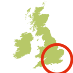
- Location: Most westerly point of the Channel Islands
- Size: 15.6 hectares
- Terrain: easy footpath on the island; some slippery sections on the causeway (wear good boots)
- Access: tidal causeway at low tide only (and not possible for several days each month on certain tides). Always check causeway opening and closing times for safe access at the States of Guernsey website. Please note that no dogs are allowed on the island; and during spring/early summer some of the areas will be roped off to protect the nesting birds.
- Height gain: 74 meters
- Map: Bailiwick of Guernsey: States of Guernsey Official Map
- Accommodation/food:
Nothing on the island but refreshments van near L’Eree Bunker (seasonal). Hotels nearby.
- Island Summary:
the most westerly point of the Channel Islands this windswept island is teeming with bird and plant life. Inhabited only by the visitors to Lihou house this is a great opportunity to experience one of the more tranquil places that the Channel Islands have to offer
- Look out for:
- Plunging into the depths of idyllic Venus Pool
- Rich and varied rock-pool life along the causeway
- Spotting waders on the shore and seabird colonies offshore
- Off-island adventuring away from the bustle of Guernsey
- Route description:
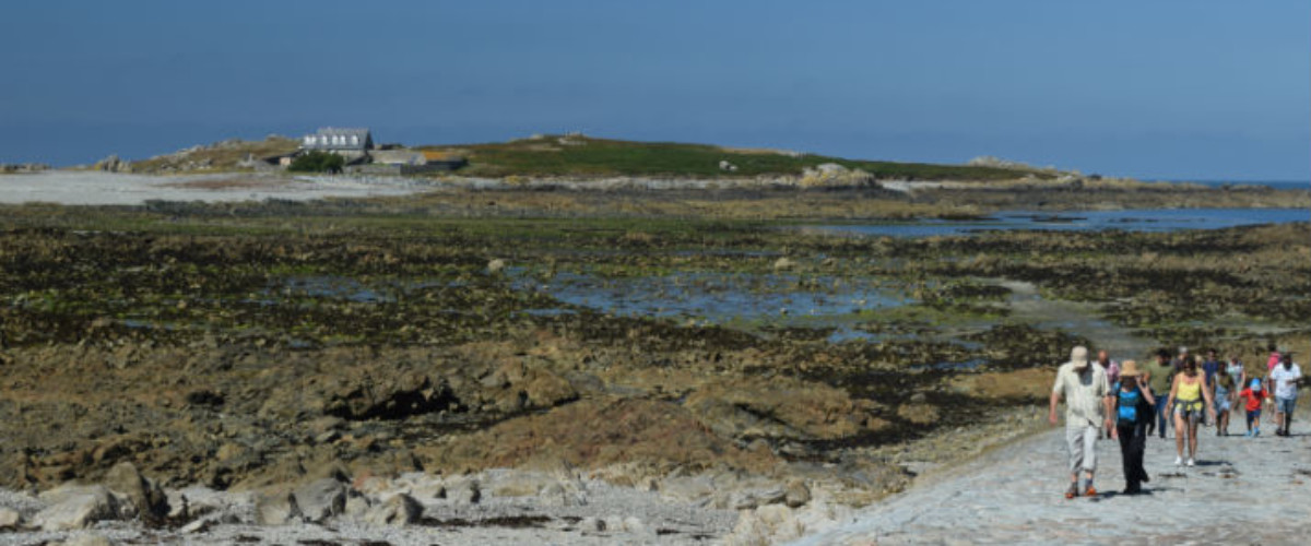
starting on Guernsey mainland and passing the imposing L’Eree bunker and Fort Saumerez then walking across the ocean floor via the seaweed-covered gravel, rock and cobbles of the causeway provides an fascinating introduction to the island and its history. On arrival there is a clear footpath that passes the remains of the Priory and the Venus Pools. With wonderful views across the expansive Rocquaine Bay and the fortifications of L’Eree Headland as well as the surrounding islets it’s hard to fit everything in to the short visits that the fast tides allow.
- Getting there:
there are round-island buses that leave from St Peter Port, Guernsey and intermediate stops to L’Eree Bunker; by car there are three car parks around L’Eree Headland
NO NAMED GPX
Profile
No data elevation
Name:
No data
Distance:
No data
Minimum elevation:
No data
Maximum elevation:
No data
Elevation gain:
No data
Elevation loss:
No data
Duration:
No data
Description
Lihou
Join our Islandeering community
We continuously find new islands, rivers, lochs, canals and coast to walk, SUP and swim in and meet plenty of great folks along the way. Join our community to get new routes and adventures, latest blogs and news by using the email box below. Tune in also to our Facebook and Instagram pages to see where we are going next.

Share via...
Gallery
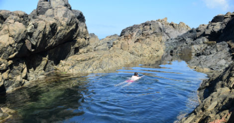
A refreshing dip in the Venus Pool
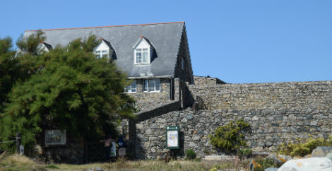
Lihou House
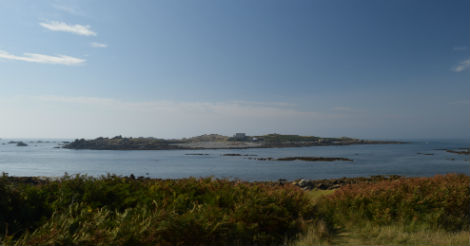
View of Lihou from the mainland with the fist signs of the causeway appearing
