No activities have been added for this island yet.
Luing
Share via...
56.234372, -5.638918
About Us

Hi and welcome to Islandeering Islandeering is for people who want adventure in Britain’s wild blue spaces – our rivers, coast, lakes, canals and islands. You will find amazing walks, paddles and swims in the UK’s most special places, those recognised for outstanding natural beauty, incredible geology or special and abundant wildlife.
Learn More
Learn More
Distance: 23.5 km
Difficulty: Moderate
Method: Walking
Wow Factor: 7 out of 10
Key Facts
- Location: Inner Hebrides
- Size: 1430 hectares
- Terrain: Foreshore of mixed grass, sand and easy rocks with some boggier walking; minor island roads and good tracks
- Access: Ferry
- Height gain: 430 metres
- Map: OS Explorer 359
- Starting point: Cuan Ferry jetty. Lat/Long: 56.266333, -5.633206; GR NM 75115 14141
- Accommodation/food:
The Luing Store, on the road south of Cullipool; the Atlantic Centre has toilets and a café serving hot and cold food; the Luing Bakery in Cullipool has the usual range of bakery products but check opening times first. A range of self-catering and B&B accommodation. Wild camping throughout the island.
- Island Summary:
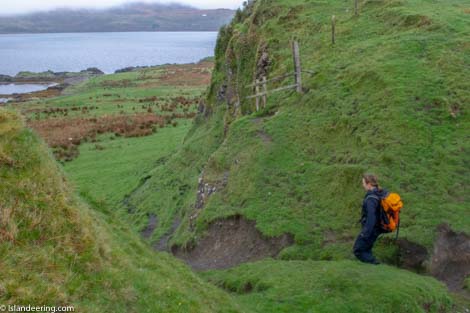
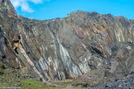
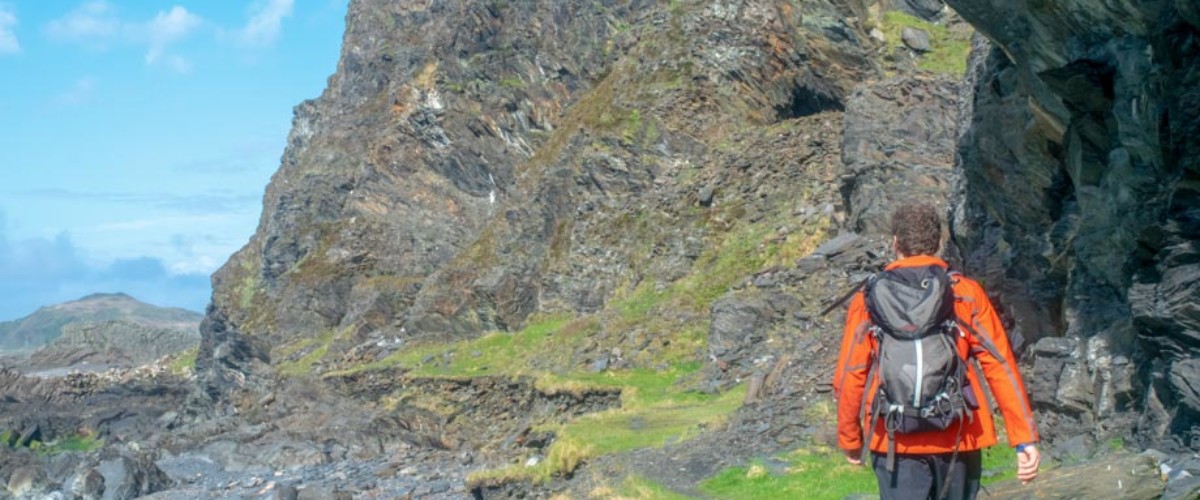
Nestled in the Firth of Lorn, just 50 minutes south of Oban, Luing is reached by a short ferry crossing from the Isle of Seil. The most southerly of the four Slate Islands it provides a fascinating window into the industrial past and the sheer scale of its slate production has left a surreal landscape of fractured cliff walls that appear to teeter on collapse and are thrilling to walk beneath. With a low lying coast and a band of rocks that elevate the central spine of the island the southern half of the island it is a peaceful retreat with stunning views throughout.
- Look out for:
- Home-made food at the Atlantic Centre
- Ancient towers of otter spraints
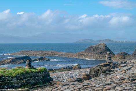
- Stone skimming on slate beaches
- Exploring the disused quarries and old workings around Cullipool
- Route description:
The walk is generally peaceful and remote and for most of the southern half of the island is free-range along the foreshore. Starting in the north, the clockwise route follows a good track along the rural east coast of Luing to the harbourside hamlet of Toberonochy before it merges into a gentle and remote foreshore walk around the southern portion of the island. Along the west coast the route climbs along the Sound of Luing and affords great views of Mull, Scarba, Fladda and the Garvellachs with Colonsay, Islay and Jura in the far distance. The main village of Cullapool has a welcoming community café and island bakery and the immense slate quarries and workings that stretch throughout the northern end of the island make for great exploration.
- Getting there:
From Oban drive south on the A816 then onto the B844 and B8003 to reach the small village of North Cuan on the Sound of Cuan. From here the Luing Ferry crosses the Sound to reach the island. Further information about the Luing Ferry can be found at Caledonian MacBrayne Ferries https://www.calmac.co.uk/article/3121/Cuan—Luing
Join our Islandeering community
We continuously find new islands, rivers, lochs, canals and coast to walk, SUP and swim in and meet plenty of great folks along the way. Join our community to get new routes and adventures, latest blogs and news by using the email box below. Tune in also to our Facebook and Instagram pages to see where we are going next.

Share via...
Gallery