
Mersea Island
Share via...
51.787732, 0.953699
About Us

Hi and welcome to Islandeering Islandeering is for people who want adventure in Britain’s wild blue spaces – our rivers, coast, lakes, canals and islands. You will find amazing walks, paddles and swims in the UK’s most special places, those recognised for outstanding natural beauty, incredible geology or special and abundant wildlife.
Learn More
Learn More
Distance: 21.5 km
Difficulty: Easy
Method: Walking
Wow Factor: 7 out of 10
Key Facts
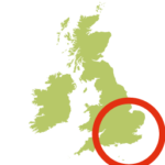
- Location: Essex
- Size: 1800 hectares
- Terrain: Flat grass paths
- Access: Road bridge (tidal)
- Height gain: 50 metres
- Map: OS Explorer 184
- Starting point: Coast Road carpark, opposite West Mersea Yacht Club
- Accommodation/food:
Accommodation on Mersea Island is a bit limited, with a few B&B’s, a pub and the vineyard. Mersea Island food is a real treat with seafood shacks in West Mersea; and a café and vineyard in East Mersea; and a cafe at Cudmore Grove County Park
- Island Summary:
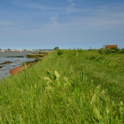
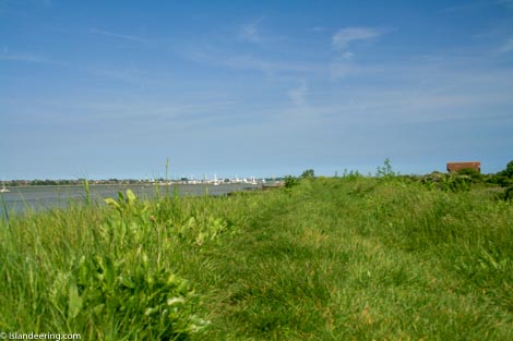
Walking the coast path around Mersea Island varies between the gentle wilderness of the Strood and Pyefleet channels of the north coast, and the holiday resorts of the North Sea-facing south coast. The coast path is flat and easy walking, with plenty of great pitstops along the south coast.
- Look out for:
- Enjoying local fizz and beer
- Watching the incredible birdlife in the creeks
- Swimming across to Packing Shed, Cobmarsh, and Sunken Islands
- Shucking oysters at The Company Shed
- Route description:
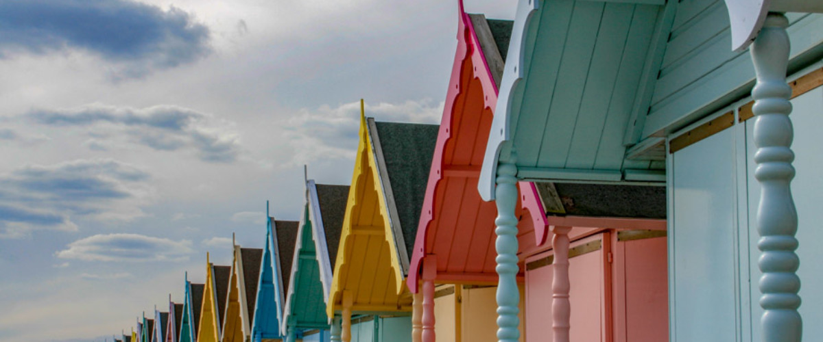
The coast path around Mersea Island starts at West Mersea and quickly gets wilder as it follows the sea wall along the north coast alongside the Strood and Pyefleet Channels. Rounding the eastern tip of the island it passes the low small Jurassic cliffs and woodland of Cudmore Grove Park. Sand and shingle beaches, front gardens of holiday parks, large houses and colourful beach huts then dominate the south coast route back to West Mersea.
- Getting there:
From Colchester take the B1025 south; the Strood is closed for certain high tides. Avoid tides greater than 5.00 metres; for these tides allow up to an hour and a half either side of the tide to get on or off the island safely https://www.tidetimes.org.uk/west-mersea-tide-times
Join our Islandeering community
We continuously find new islands, rivers, lochs, canals and coast to walk, SUP and swim in and meet plenty of great folks along the way. Join our community to get new routes and adventures, latest blogs and news by using the email box below. Tune in also to our Facebook and Instagram pages to see where we are going next.

Share via...
Gallery
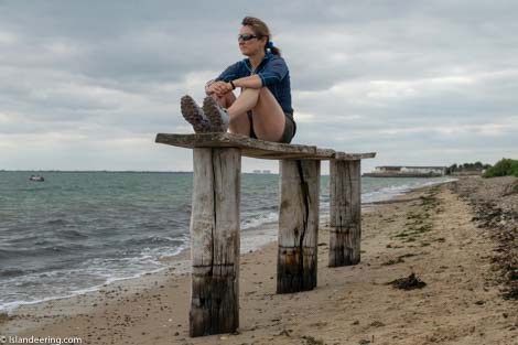
Mersea Island circular walk

Mersea Island seafood
Mersea Island circular walk - south coast
