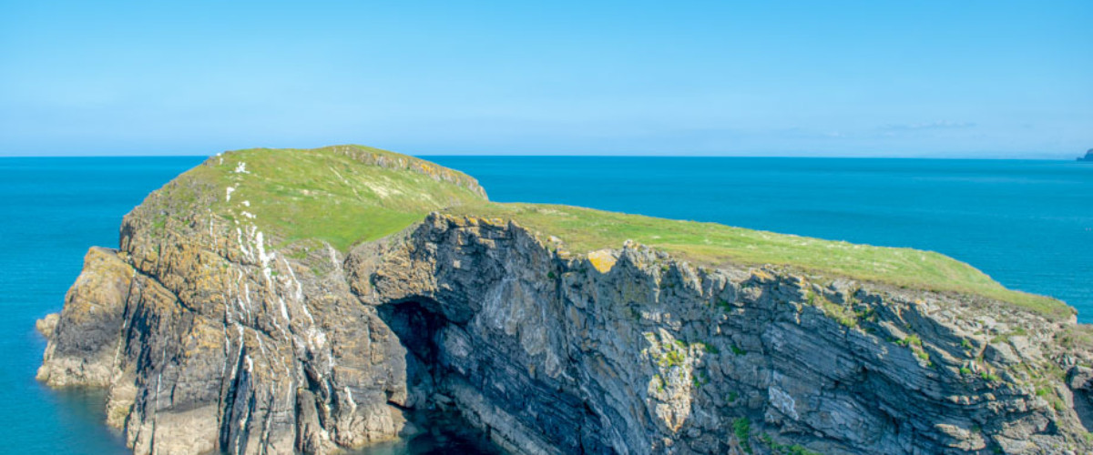
Ynys Lochtyn
Share via...
52.172963, -4.466125
About Us

Hi and welcome to Islandeering Islandeering is for people who want adventure in Britain’s wild blue spaces – our rivers, coast, lakes, canals and islands. You will find amazing walks, paddles and swims in the UK’s most special places, those recognised for outstanding natural beauty, incredible geology or special and abundant wildlife.
Learn More
Learn More
Distance: 4.4 km
Difficulty: Difficult
Method: Walking; scrambling
Wow Factor: 9 out of 10
Key Facts
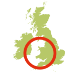
- Location: Cardigan Bay, West Wales
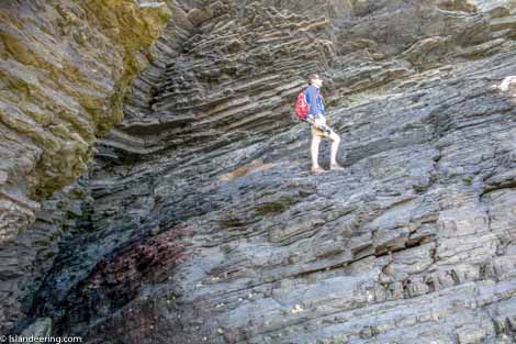
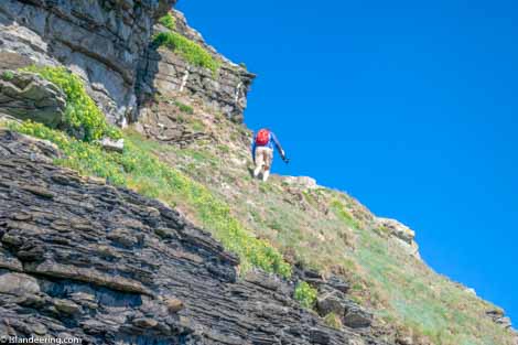
- Terrain: Easy coastal path; and steep lose route down the cliffs; scrambling on the island
- Access: Tidal beach
- Height gain: 237 metres
- Map: OS Explorer 198
- Starting point: Ynys Lochtyn headland. Lat/Long 52.171058, -4.466201. GR SN 31445 55401
- Accommodation/food:
Cafes, inns and loos at Llangrannog.
- Island Summary:
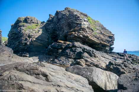
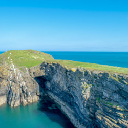
This small, wild and tidal island is a high grass-topped plateau that sits adjacent to the Ynys Lochtyn headland from which it is cut off on all but the lowest of tides. Surrounded by steep cliffs that jut into Cardigan Bay with a treasure trove of caves, rock ledges and beaches there is a thrilling sense of exposure here. It is an extraordinary spot from which to enjoy the whole sweep of Cardigan Bay, with the craggy outline of the Llŷn peninsula that can be seen to the north on clear days.
- Look out for:
- Feel dizzy atop the spectacular cliffs
- Scramble on rock ledges and explore seacaves
- Poke around in huge rockpools
- Watch the dolphins of Cardigan Bay
- Route description:
Starting along the Ceridigion Coast Path above the vertiginous cliffs between Llangarrog and Newquay the route then descends a precipitous, loose path that drops down the sea cliffs from the headland. Once on the rocks below, the route then continues through a sea cave and onto a large ledge to ascend onto the island itself.
- Getting there:
About half way between Aberaeron and Cardigan on the A487 turn off onto the B4334 to Llangrannog.
Join our Islandeering community
We continuously find new islands, rivers, lochs, canals and coast to walk, SUP and swim in and meet plenty of great folks along the way. Join our community to get new routes and adventures, latest blogs and news by using the email box below. Tune in also to our Facebook and Instagram pages to see where we are going next.

Share via...
Gallery