
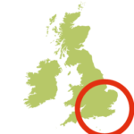
- Location: Channel Islands
- Size: 11950 ha
- Terrain: Defined coast path; some steep rockier sections
- Access: Ferry; air
- Height gain: 1660 metres
- Map: State of Jersey Official Map
- Starting point: St Helier
- Accommodation/food:
Jersey has a full range of accomodation in St Heliers as a base or around the coast path
- Activity Summary:
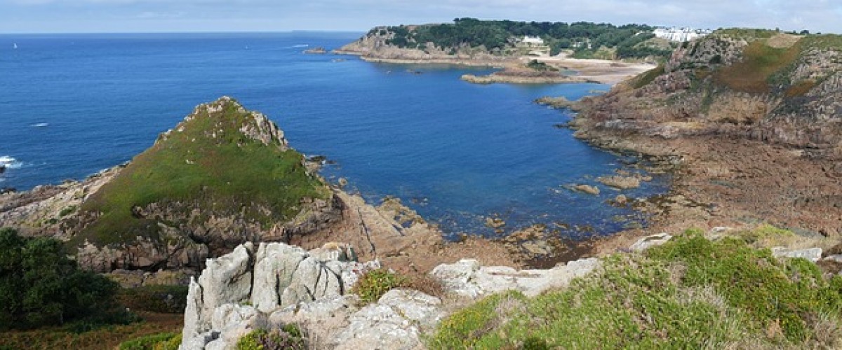
The Jersey Coast Path is a magnificent 77 km circular coastal walk most of which sits within the Jersey National Park and offers the very best of coastal scenery and natural beauty with plenty of excellent foodie stops on the way. The route can be walked in four days either using its capital, St Heliers, as a base or using plentiful accommodation on the way. The Jersey Coast Path can also be completed as a day challenge as part of the annual charity event, The Island Walk https://www.islandwalk.je. The Jersey coast equally offers many highlights that make for excellent shorter walks, including the low tide walk to the striking 16th century St Elizabeth’s Castle.
- Route description:
The first section of the coast path follows the huge sweep of St Aubin’s Bay. After the flatness of the Bay it’s a relief to use a different set of muscles to climb through the wooded headland then further exercise them by descending steeply to the idyllic Portelet Bay with high cliffs sheltering the beach, golden sand, rock pools. There is also an option for a tidal crossing to the islet of L’Île au Guerdain and visit Janvrin’s Tomb.
Continuing around the vast curves of St Brelade’s and St Ouen’s Bays, a stop for barbequed seafood and a beer in Faulkner Fisheries’ quirky and excellent restaurant located in a converted German Bunker in L’Étacq is a must. Another great spot for a stop and ponder follows the climb up to Grosnez Castle at the island’s north-west tip before descending to Plemont beach, a beautiful, secluded cove with a great network of caves to explore with a sandy beach and scattering of large rocks.
The walk along Jersey’s north coast is rockier, with steep cliffs down to hidden bays with the sandy sheltered beach of Grève de Lecq one of the island’s most popular and with a large cave that runs all the way through the headland to explore. A delightful cliff walk to La Falaise with a short detour to Devil’s Hole viewing platform is well worth the effort before continuing on along the clifftop to Sorel and the large quarry at Ronez, Jersey’s most northerly point, requiring you to veer inland for a short stretch then return to the coast to view Wolf’s Caves.
Passing through a series of small bays, sweeping, pebbly Bouley Bay Beach sits next to the highest cliffs on the island and a stop at Mad Mary’s Cafe is a must. Continuing along the cliffs to Rozel, almost the most northerly point of Jersey, offers further excellent pitstops including The Hungry Man for its legendary breakfast. Quiet road walking leads to Mont Orgueil Castle (Gorey) before rejoining the sea wall of Grouville Bay to walk past a magnificent beach to Fort Henry. After that, the walker passes a number of former defence towers before reaching the ‘moonscape’ of La Roque and St Clement’s Bay, the starting point of many optional night time walks to see the glowing bioluminescence on the beaches.
- Getting there:
Get to Jersey by Condor Ferries from Portsmouth and Guernsey and the Manche Ille Express from Normandy Granville and Barneville-Carteret, France. Direct flights arrive from many European destinations
