No activities have been added for this island yet.
Chapel Island
Share via...
Chapel Island, United Kingdom
About Us

Hi and welcome to Islandeering Islandeering is for people who want adventure in Britain’s wild blue spaces – our rivers, coast, lakes, canals and islands. You will find amazing walks, paddles and swims in the UK’s most special places, those recognised for outstanding natural beauty, incredible geology or special and abundant wildlife.
Learn More
Learn More
Distance: 4.5 km
Difficulty: Easy walk (only with Queen's Guide to the Sands)
Method: Walking (and wading)
Wow Factor: 7 out of 10
Key Facts
- Location: Canal Foot, Ulverston, Cumbria
- Size: 3 hectares
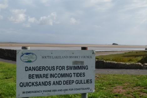
- Terrain: Estuarine sands and quicksands
- Access: Tidal crossing of Leven’s Channel
- Height gain: 16 metres
- Map: OS Explorer OL7
- Starting point: Bay Horse Hotel. Lat/Long 54.189374, -3.053600; GR SD 31348 77580
- Accommodation/food:
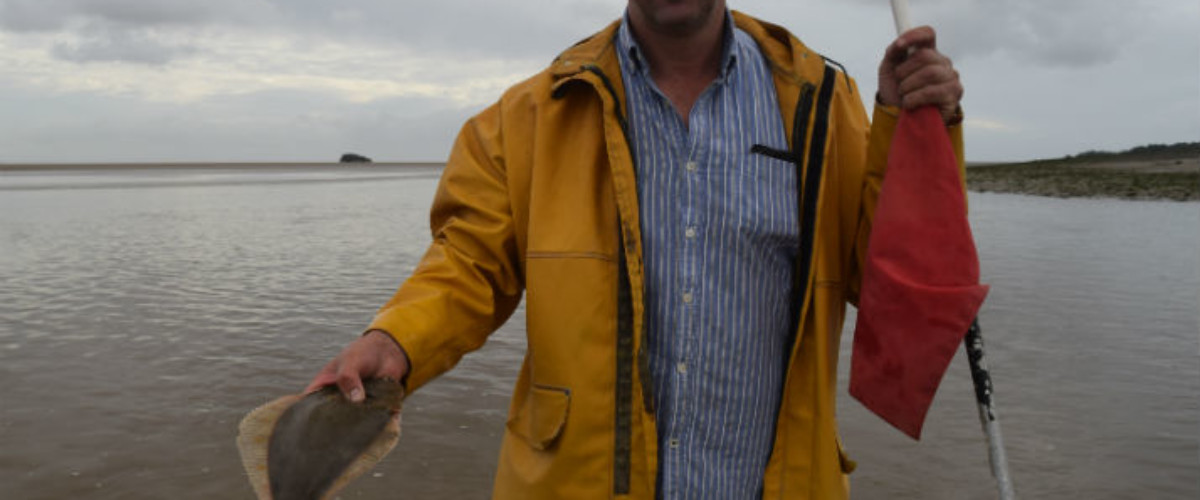
Accommodation and food at Bay Horse Hotel, Canal Foot. Full services in Ulverston – best tea and cake at Gillam’s. Ray, the Queen’s Guide to the Sands, also catches and sells his own shrimp
- Island Summary:
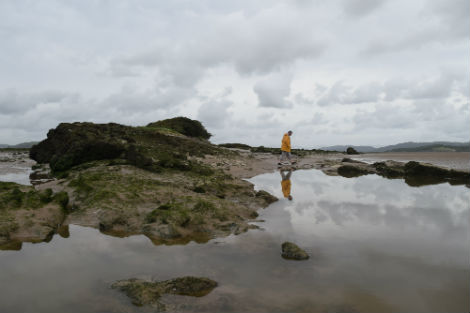
A limestone outcrop that hovers above the treacherous sands of Morecombe Bay in the Leven Estuary with the mountains of the Lake District as a backdrop. The crossing of the channel at Canal Foot is a bit of an adventure when the channel is in full spate even at low tide so don’t be tempted to try it without a guide. Contact info@guideoversands.co.uk or find out more information here
- Look out for:
- Quicksands
- Views of Blackpool Tower
- Most southerly colony of Eider ducks
- Raymond Porter, Queen’s Guide to the Sands catching flounders in the channel with his feet
- Route description:
Crossing the Level Channel at Canal Foot and walking on sand banks to the island it is possible to walk around the island at low tide. The island itself is covered in impenetrable vegetation, although the remains of the buildings can still be seen.
We have not included the GPX or the route description here, as we want to encourage all walkers to walk with the Queen’s Guide to the Sands and stay safe.
- Getting there:
There is a small carpark available at Canal Foot; the walk along the Ulverston Canal from Ulverston itself makes for a great extension to this route with parking and hot food available at Booths. By rail the Furness Line from Barrow in Furnace to Lancaster stops at Ulvertson and if approaching from the south you get great views over to the island and the sands around it when crossing the Leven’s aqueduct.
Islands nearby:
Meet the royal family on Piel Island
Foulney, Sheep and Roa (contact us for more information, we have bagged them multiple times, just not written them up yet)
Join our Islandeering community
We continuously find new islands, rivers, lochs, canals and coast to walk, SUP and swim in and meet plenty of great folks along the way. Join our community to get new routes and adventures, latest blogs and news by using the email box below. Tune in also to our Facebook and Instagram pages to see where we are going next.

Share via...
Gallery
Always go with a guide! Chapel island in the distance.
Southern tip of island with the Lake District in the background
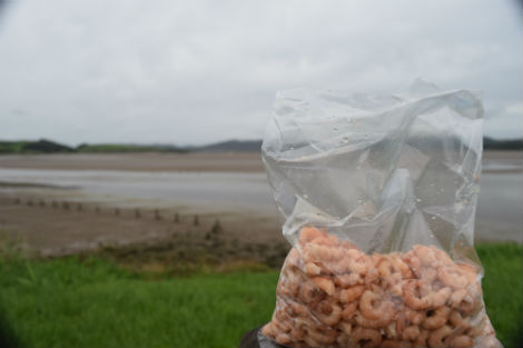
Don’t forget to get a bag of Ray’s deliciously fresh brown shrimp