56.018211, -6.242265
About Us

Learn More
Overview: an island of dramatic scenery, glorious machair, corncrakes, choughs, seal colonies and more. The island is privately owned, with the RSPB managing the island for wildlife. It can only be accessed by crossing the tidal sands of the Strand, often following the tyre tracks left by the postman’s van.
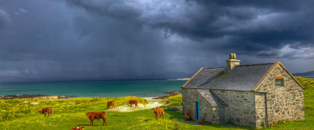
The interior of the island is dominated by the bulk of Beinn Oronsay, where the resident choughs are often spotted, and is a mix of moorland and farmland. Most visitors head along the island’s main track to the ruins of the 14th Century priory, with its ossuary of human skulls and bones and carved Celtic Cross – one of the best examples of its kind.
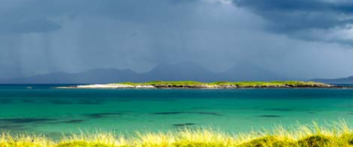
If tides permit it is possible to have longer on the island and walk the island circuit to visit the magnificent beaches on the east and west coasts, the seals on the skerries off the island’s south tip and the shell middens. The coastal route returns inland at Seal Cottage where it is possible to sup the refreshing spring water. The views across to the Paps of Jura are stunning throughout the coastal walk.
Oronsay is a fabulous destination for wildlife lovers. In addition to the chough, corncrake and seals, birds such as skylarks, twites, lapwings, redshanks and ringed plovers all thrive here, as do rare marsh-fritillary butterflies. Around 3,500 barnacle geese visit in the winter, and in the summer the wildflower meadows and machair come into full bloom, including one field with over 100 Irish ladies-tresses, a very rare orchid.
Type of island: tidal; inhabited
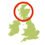
Location: Off Colonsay, Inner Hebrides
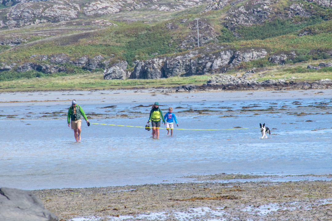
How to get to Oronsay: Calmac ferry to Colonsay from Oban. Once on the island take the B8086 at Scalasaig, pass the Colonsay Hotel and after 1.3 km turn left onto the B8085 to reach the head of the causeway at the road end. Cross the tidal sands
Getting around Oronsay: a main tack leads from the head of the tidal causeway on the island to the Priory, House and Farm and RSPB areas; clear paths lead around the coastline.
Best time to go to Oronsay: machair and rare orchids in the late spring/summer; corncrakes April – September; winter months ideal for walking the coastal path as no nesting birds; also the best time to spot the seal colony and pups off the island’s south tip.
Access to Oronsay: the best time to cross is during neap tides (the two days following a New Moon or a Full Moon) allowing 4-5 hours for the trip. Always cross on an ebbing tide. Tide tables are posted at Colonsay’s CalMac office, the General Stores and the Colonsay Hotel.
Dog friendly: On a lead (farmland and birds)
Food and drink: there are no visitor facilities on the island; the closest is on Colonsay where there is:
The Pantry – right by the harbour that sells freshly baked bread, cakes and biscuits; light lunches and suppers.
Colonsay House Gardens Cafe – soups, filled bread rolls, tarts, teas and coffees and home-baked cakes served on a large sunny garden terrace overlooking the garden.
The Colonsay Hotel – gastro-pub and bar
Accommodation on Oronsay: none on Oronsay but a number of options on Colonsay ranging from hotel, B&B, self-catering, hostel and camping (no camper vans or motorhomes permitted on the island) check them out here
Contacts: the post office on Colonsay, is the best source of information on the tidal crossing, telephone number 01951 200323.
Best things to do Oronsay:
- Walk the coastal circuit – see the Islandeering route
- Swim off glorious beaches
- Watch the brooding skies above the Paps of Jura
- Visit the ruins of the Augustinian Priory
- Enjoy the colours and insects of the machair
Look out for:
- Choughs
- Corncrakes
- Seal pups
- Irish Lady’s Tresses
Nearby islands: whilst you are there, why not explore:
Colonsay – more here
Join our Islandeering community
We continuously find new islands, rivers, lochs, canals and coast to walk, SUP and swim in and meet plenty of great folks along the way. Join our community to get new routes and adventures, latest blogs and news by using the email box below. Tune in also to our Facebook and Instagram pages to see where we are going next.

Share via...
Gallery
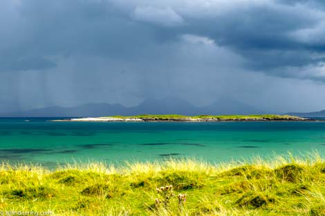
Views across to the Paps of Jura
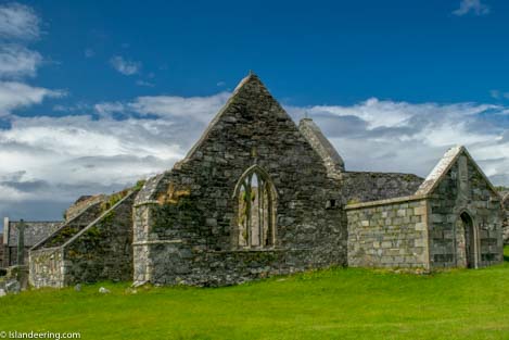
Oronsay Priory
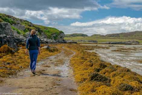
The start of the track on Oronsay
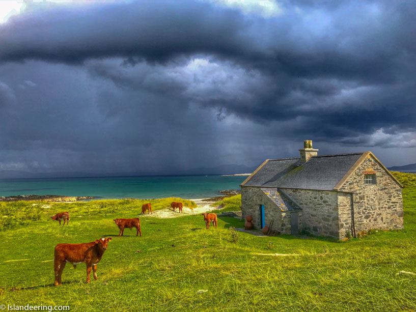
Seal Cottage