
No activities have been added for this island yet.
Rousay
Share via...
Rousay, Orkney, United Kingdom
About Us

Hi and welcome to Islandeering Islandeering is for people who want adventure in Britain’s wild blue spaces – our rivers, coast, lakes, canals and islands. You will find amazing walks, paddles and swims in the UK’s most special places, those recognised for outstanding natural beauty, incredible geology or special and abundant wildlife.
Learn More
Learn More
Distance: 25 km
Difficulty: Easy
Method: Walking
Wow Factor: 10 out of 10
Key Facts
- Location: Orkney Islands
- Size: 4,860 hectares
- Terrain: Tarmac single-track road; some steeper hills
- Access: Ferry from Tingwall, mainland Orkney
- Height gain: 530 metres
- Map: OS Explorer 464
- Starting point: Rousay ferry pier
- Accommodation/food:
Taversoe Inn for B&B and pub. Also self-catering, camping and hostel http://www.discoverrousay.co.uk/accommodation.shtml
- Island Summary:
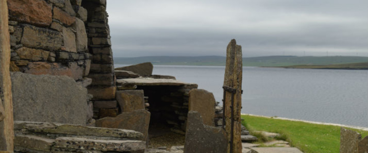
Known as the Egypt of the North a walk along the Westness Heritage Trail and its mile of mind blowing history will leave you in no doubt as to how this island earnt its name. As the second most hilly island after Hoy though it has a lot more to offer the walker than history. The road climbs almost to the top of the steeper hills of the island offering unparalleled views of the other islands in the archipelago. Also, the island secures itself as a rich wildlife experience by virtue of its diversity of habitat from moorland and seashore to luxuriant maritime heath.
- Look out for:
- The built remains of the Stone Age, Iron Age, Vikings and early crofters
- Views across to Faraclett Head from the flanks of Kierfea Hill
- Otters in the Bay of Saviskail
- Every other lovely local driver stopping to ask you if you want a lift!
- Route description:
This is an on-road route following the islands main circular, single-track road. With two prolonged hills known as ‘The Leeon’ and the ‘Sourin Brae’ that climb either side of Kierfea Hill in the north of the island this route will exercise even the fitter walker, particularly if they are time constrained by ferries or want to spend significant time absorbing the island’s rich history. The south coast is very agricultural and gentle whilst the north coast is steeper with rugged cliffs and rougher seas. The east coast is low-lying and more highly populated whilst the west coast is a long, remote stretch that passes through high moorland landscape.
- Getting there:
Orkney Ferries sail regularly from the island to Tingwall on the Orkney Mainland to Rousay.
Join our Islandeering community
We continuously find new islands, rivers, lochs, canals and coast to walk, SUP and swim in and meet plenty of great folks along the way. Join our community to get new routes and adventures, latest blogs and news by using the email box below. Tune in also to our Facebook and Instagram pages to see where we are going next.

Share via...
Gallery
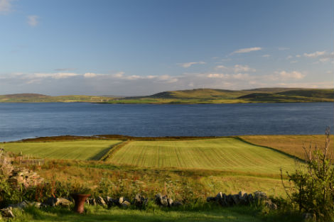
Gentle agricultural scenes along the south coast
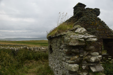
Mind-blowing history along the heritage walk
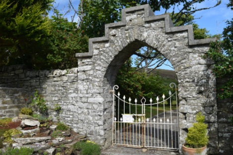
The beautiful, tranquil gardens at Trumland House
