

There are no facilities or water on the island. The closest restaurant is the fabulous Machair Kitchen at Talla na Mara Community Enterprise Centre south of Horgabost on the A859.
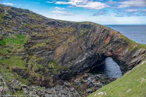
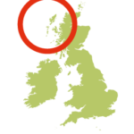
Taransay lies 3 kilometres from Harris across the Sound of Taransay in the Outer Hebrides. Uninhabited since the 1970’s there are plenty of ruins and place names that enable the islandeer to piece together what life was once like here dating back to Celtic pagan, Christian and Viking times. Geographically, the island is divided almost in two. The landing beach and the pre-clearance townships of Paibeil, Uidh and Raa lie on the southeastern part of the island, the topography of which is dominated by the bulk of Beinn Raah. The smaller, wilder west side, known as Aird Mhanais, is shaped by the smaller peaks of Bualabhal and Hearrabhal and is home to the spectacular rock arch at Roagh. The two parts of the island are joined by the beautifully secluded sandy isthmus at the head of Loch na h-Uidhe.
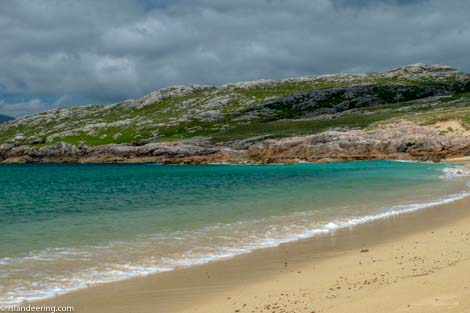
This completely free-range walk follows the deer tracks that circumnavigate the island’s outer edge. It includes stunning beach crossings, a magnificent rock arch, mysterious ruins and legends and far-reaching views with the layered-blue peaks of Harris as the backdrop. The island is a patchwork of hard rock that rises through the grass and machair, with heather moorland on the higher slopes and boggier ground in the north. As a result this rugged route is undulating and crosses a mix of terrains and is utterly enchanting.
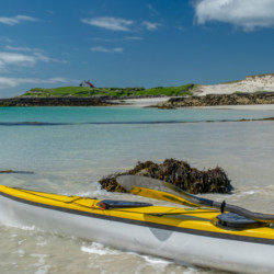
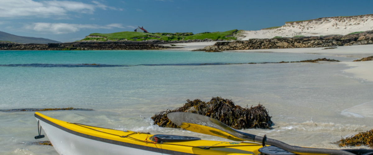
Kayak or private boat from Seilibost Beach (Lat/Long 57 52.176, -6 57.302) on Harris following a bearing of 298 degrees.
We continuously find new islands, rivers, lochs, canals and coast to walk, SUP and swim in and meet plenty of great folks along the way. Join our community to get new routes and adventures, latest blogs and news by using the email box below. Tune in also to our Facebook and Instagram pages to see where we are going next.