- Location: Holy Island, Anglesey
- Size: 3942 hectares
- Terrain: Moorland and coast path
- Access: Road bridge
- Height gain: 405 metres
- Map: OS Explorer 262
- Starting point: Holyhead breakwater Country Park (GR SH 226 832; 53.316477 , -4.6644692)
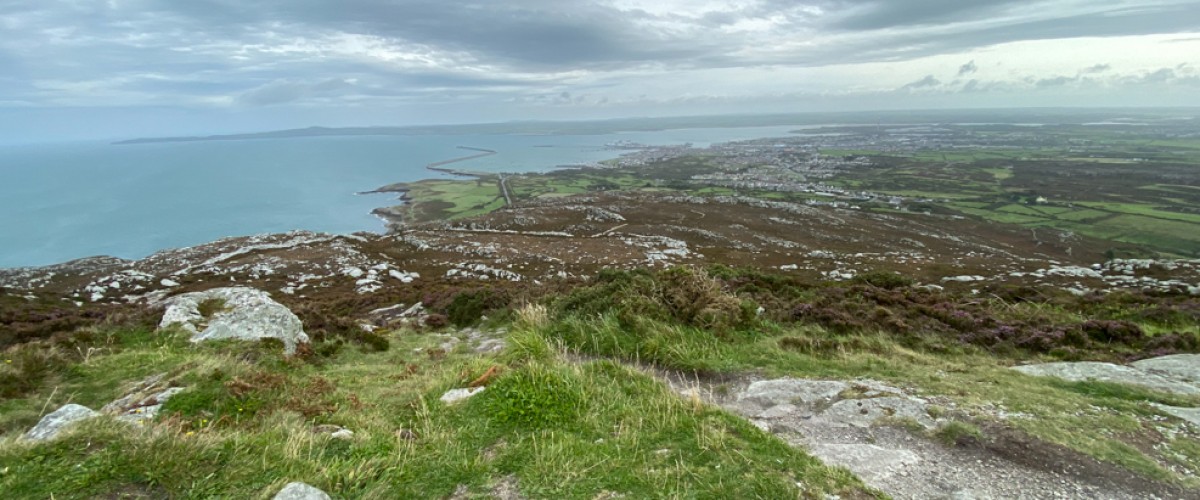
- Route description:
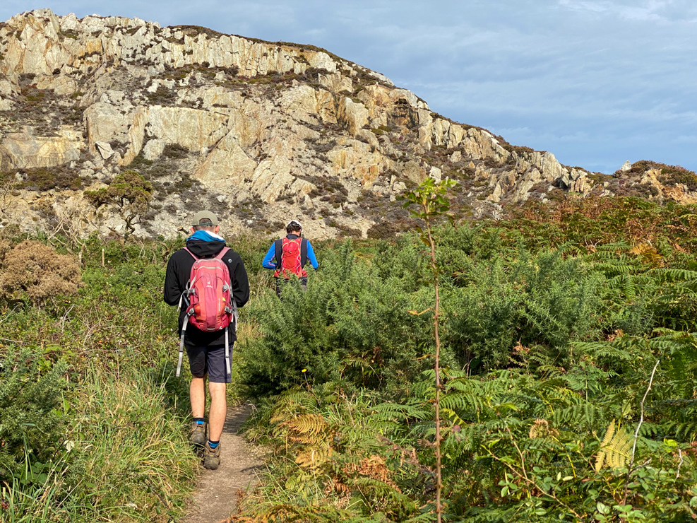
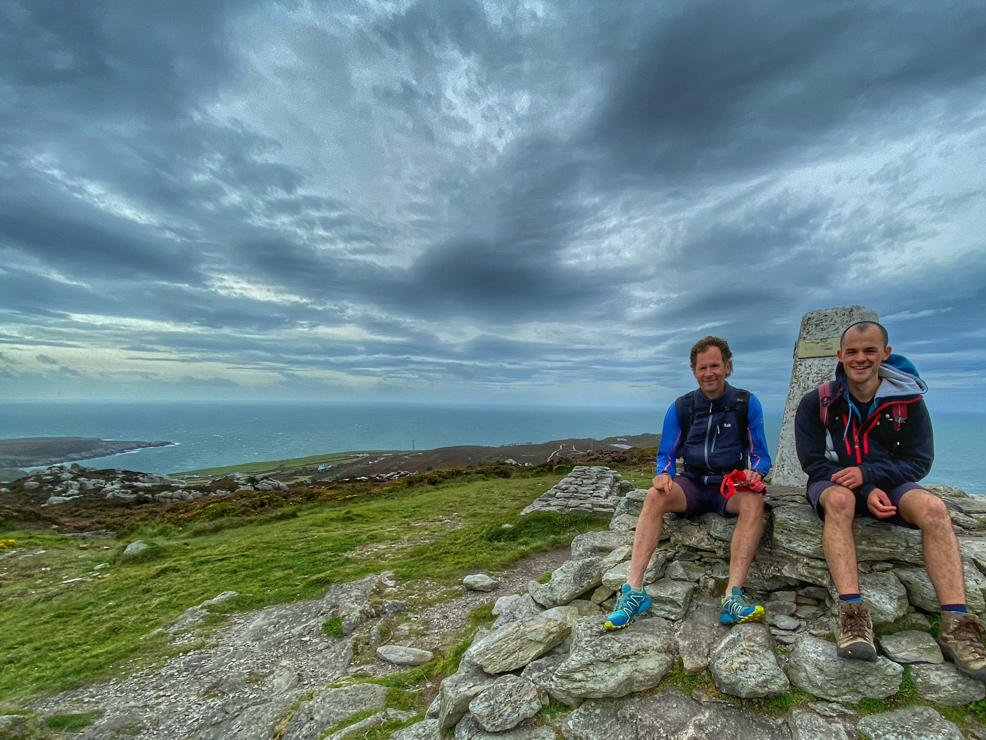
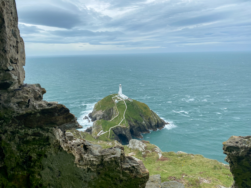
This circular walk up Holyhead Mountain combines a superb section of the coast path and some modest but rough mountain terrain. Despite its relatively low 220 metre summit it has a true mountain feel. Start at the Breakwater Country Park 4 kilometres west of Holyhead. Immediately head up the rock steps carved out of the hillside onto the Isle of Anglesey Coastal Path for great views over Holyhead Harbour and two hidden rocky bays below. The large ferries to Ireland are constantly slipping in and out of the harbour beyond the breakwater and several kilometres out to sea the islands of the Skerries can be spotted on a clear day. Continue uphill past the old magazine hut, once used by the quarry to store explosives and dynamite, until you arrive at Ynys Arw (North Stack) fog horn station, now an artist’s residence. The views from here are staggering, with precipitous sea cliffs diving into swirling seas below. Directly beneath the stack is an enormous sea cave where grey seal pups can be spotted in the autumn. Head south along the coastal footpath towards Holyhead Mountain to find the steep rocky track towards the summit. Pass the Iron Age hill fort of Caer y Twr whose walls are made of naturally occurring rocky outcrops and extensive stone ramparts that the Romans were thought to have built a watchtower within. At the trig point there are 360 degree views over Holyhead Harbour, Y Carneddau and Snowdon. From the summit, descend through a rocky landscape to reach a wide path leading to South Stack. Look out for choughs, gulls, the odd puffin and peregrine, thousands of guillemots and razorbills and the occasional porpoise. Continue to the small tourist carpark above Ellin’s Tower. To return take the path that heads north north-east from the road, then veers increasingly east towards the radio stations and skirts the southern base of Holyhead Mountain. Head into the fields with medieval field boundaries and follow the track between old dry-stone walls to reach the lane and the houses of the hamlet of Gorlan then return by path to the Country Park.
Whilst you are there:
Walk to Lladdwyn Island, Anglesey – more here