
Beautiful stained glass windows depicting ocean wildlife.
Fresh lobster and crab from Island Fish a.k.a. the Lobster man just left of the Vine cafe.

There is plenty of great food and accommodation on Bryher. Luxury accommodation at Hell Bay Hotel in the west of the island, along with various self-catering options, B&B’s and a great campsite. Cafes, restaurants and pubs on Bryher include Vine Cafe in middle of island, Fraggle Rock bar/cafe in the north east of the island and don’t miss the Hell Bay’s Crab Shack’s local crab, mussel and scallop feast. Well-stocked shop in The Town stocking the delicious island tattie cake.
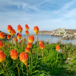
The coast path around Bryher varies between the rugged west coast, pounded by Atlantic waves, and the tranquillity of the sheltered east coast with its quiet sandy beaches. With a pub called Fraggle Rock and the location for inspiring and filming Michael Morpurgo’s, “Why the Whales Came”, ancient burial sites and plenty of wildlife and wild swims this island offers huge variety and interest to the walker. There are plenty of high quality refreshment stops too, along with temptation from the stalls selling fresh island produce and the delicious Veronica’s fudge dotted along the way. You’ll not go hungry here!
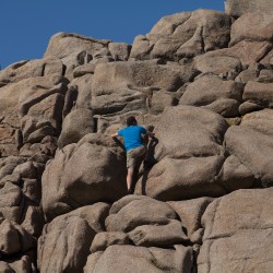
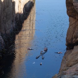
The circular walk around the coast of Bryher starts at The Church Quay and heads north, up the east coast, passed traditional boatyards to Fraggle Rock Bar and then onto the wilds of Shipman Head Down and one of the largest Bronze Age burial sites in northwest Europe. Rounding the northern tip, the west coast is dramatic with cliffs and sentinel rocks exposed to the full power of the Atlantic and the aptly named Hell Bay. Heading south the landscape becomes much gentler at Stinking Porth, around the Hell Bay Hotel, with the brackish and calm waters of Great Pool a magnet for migrating birds. The path climbs again to reach the westerly points of Gweal Hill and Heathy Hill with Droppy Nose Point, a charismatic rock formation and a favourite haul out site for seals. The dramatic, jagged Norrard Rocks can be seen from both hills. The south coast then becomes flatter with the sands of Rushey Bay before skirting around the base of Samson Hill, the location for the film based on Michael Morpurgo’s book, “Why the whales came”, after which the route gently returns to the Quay. Don’t miss a swim in the gully at Shipman Head or Rushy Bay.
Inter-island ferries from St Mary’s or Tresco.
We continuously find new islands, rivers, lochs, canals and coast to walk, SUP and swim in and meet plenty of great folks along the way. Join our community to get new routes and adventures, latest blogs and news by using the email box below. Tune in also to our Facebook and Instagram pages to see where we are going next.

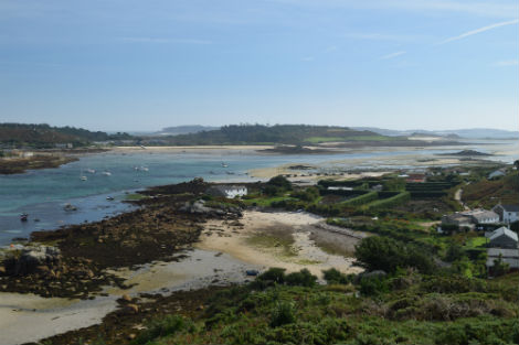
The Town with Tresco in the background.
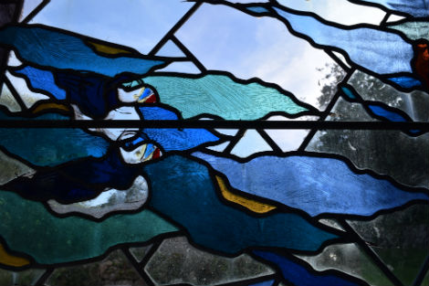
The inscription on the stained glass windows in All Saints church reads “Let the waters bring forth abundantly the moving creature that hath life, and fowl that may fly above the earth in the open firmament of heaven”.
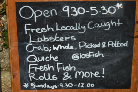
The sweetest seafood for a sumptous picnic.
