No activities have been added for this island yet.
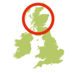
North Ronaldsay
Share via...
59.370255, -2.418001
About Us

Hi and welcome to Islandeering Islandeering is for people who want adventure in Britain’s wild blue spaces – our rivers, coast, lakes, canals and islands. You will find amazing walks, paddles and swims in the UK’s most special places, those recognised for outstanding natural beauty, incredible geology or special and abundant wildlife.
Learn More
Learn More
Distance: 20.1 km
Difficulty: Easy
Method: Walking
Wow Factor: 8 out of 10
Key Facts
- Location: Orkney
- Size: 690 hectares
- Terrain: Easy sheep trails along the foreshore
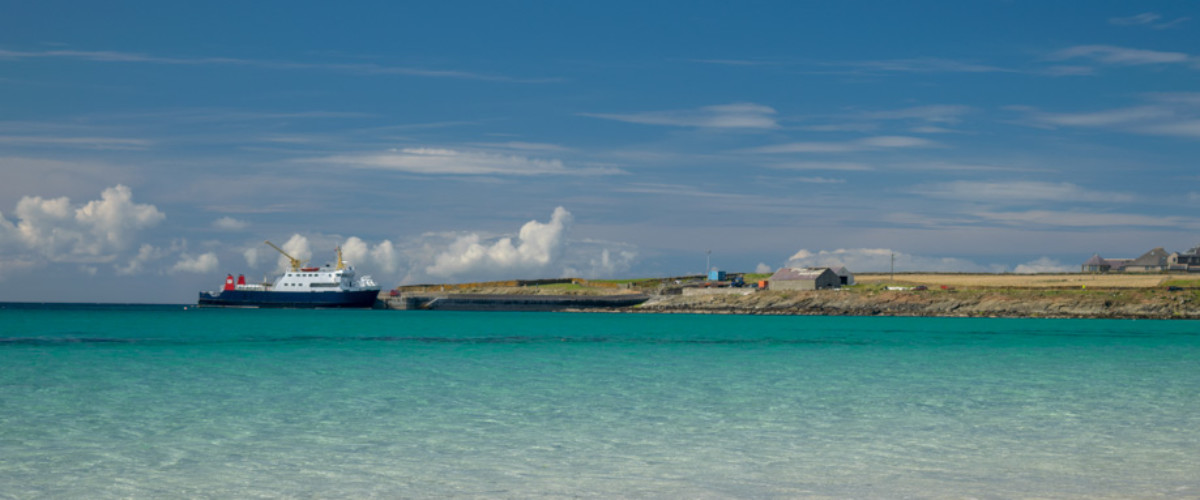
- Access: Ferry
- Height gain: 184 metres
- Map: OS Explorer 465
- Starting point: Ferry jetty. Lat/Long 59.355870, -2.441226. GR HY 75012 52255
- Accommodation/food:
The Bird Observatory has a variety of accommodation, hot food and a grocery shop. The lighthouse has self-catering accommodation and a great café.
- Island Summary:
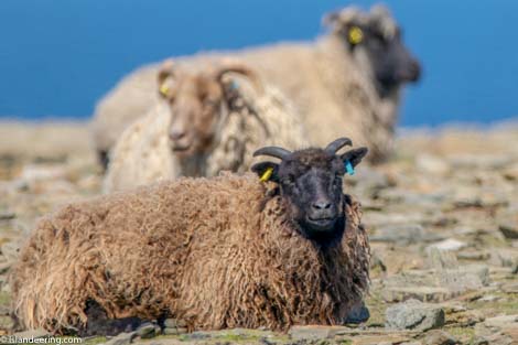
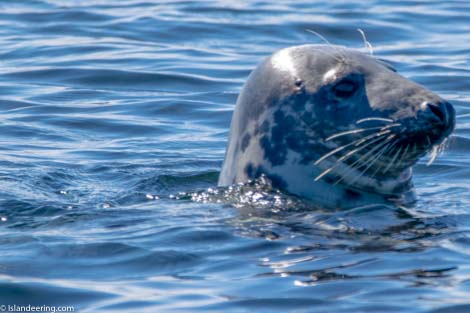
North Ronaldsay is the northernmost of the Orkney archipelago and has a definite outer isle feel. It is a remote, low lying and exposed island populated by forty or so sturdy islanders who uphold many of the island’s traditions such as singing around the island’s standing stone on New Year’s Eve and keeping the old Norn dialect alive. Its north and west coasts are made up of the rocks of the grey-blue Rousay Flags, with the tallest lighthouse in Britain at its northern tip. The south and east coasts take in the huge crescent-shaped white sands of South Bay and Linklater Bay, along with an Iron Age broch on the southernmost tip at Point of Burrian. Inland the island is extensively cultivated, with deserted lanes lined with wild flowers and stone cottages dotted throughout.
- Look out for:
- Sampling mutton pie at the Lighthouse
- Learning more about the amazing wildlife with the wardens at the Observatory
- Lighthouse tour with the keeper
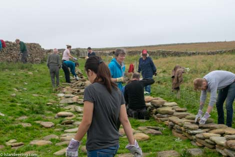
- Joining in with the wall's restoration during the Sheep Festival
- Route description:
A flat, pebble, rock-strewn and grassy foreshore walk along the nineteen kilometre stone wall of the sheep dyke. The anticlockwise route follows the infinite white sands of two bays, visits excellent Iron Age ruins and is perfectly punctuated half way around by the tasty local food and visitors centre of the lighthouse complex.
- Getting there:
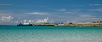
By sea: the ferry from Kirkwall operates on Tuesdays and Fridays in summer, but it is advisable to check the afternoon before the sailing because rescheduling due to the weather and tides is not uncommon. A number of Sunday excursion sailings also operate in the summer.
http://www.orkneyferries.co.uk/
By air: Loganair flights from Kirkwall operate daily http://www.loganair.co.uk/reservations/
Join our Islandeering community
We continuously find new islands, rivers, lochs, canals and coast to walk, SUP and swim in and meet plenty of great folks along the way. Join our community to get new routes and adventures, latest blogs and news by using the email box below. Tune in also to our Facebook and Instagram pages to see where we are going next.

Share via...
Gallery