
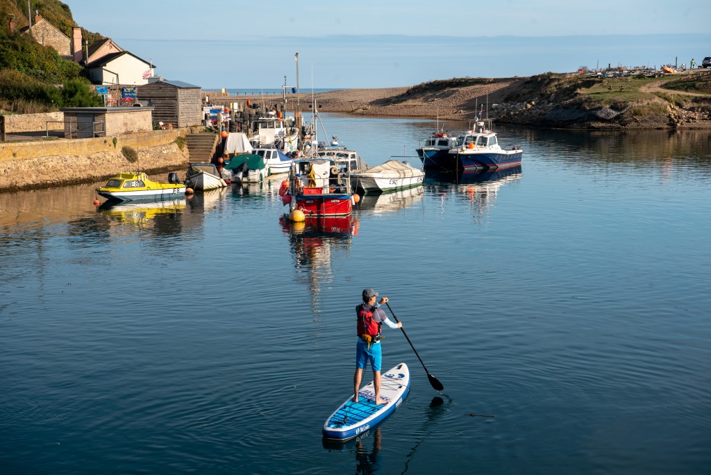
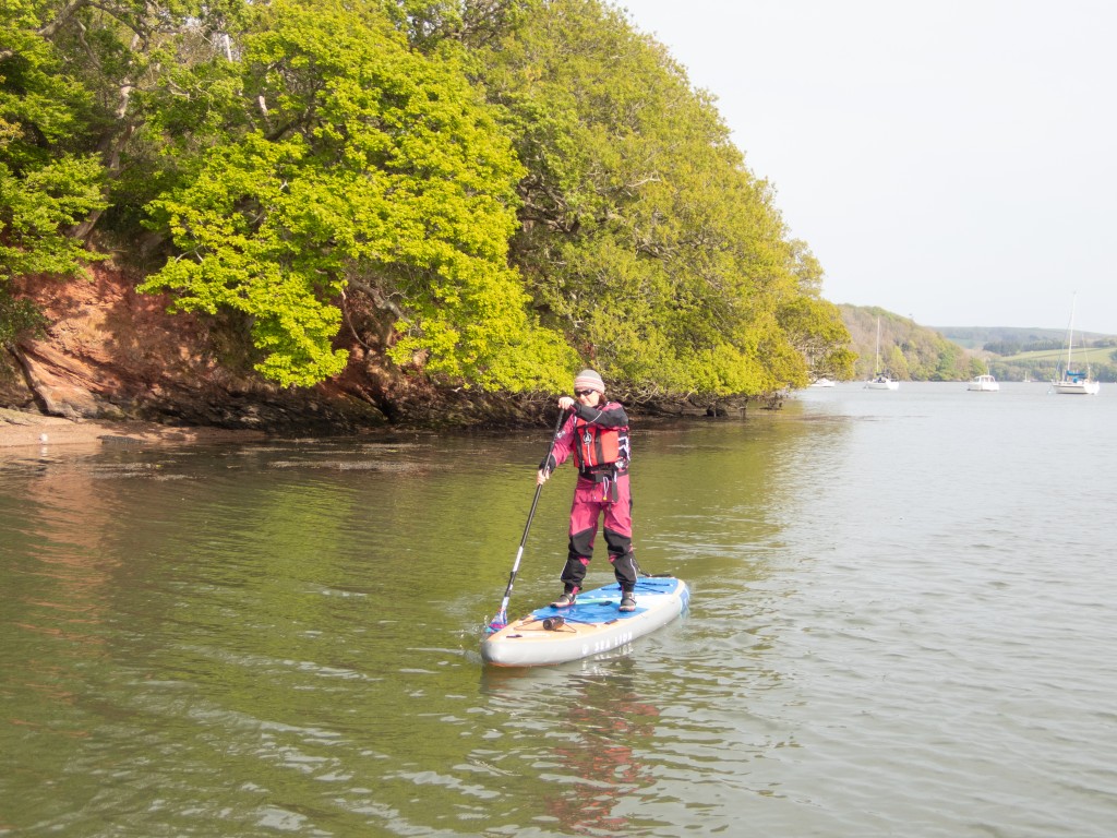
The county of Devon has some wonderful blue space with plenty of amazing places to SUP. From wild coastlines and secluded beaches to estuaries, lakes and canals there are plenty of paddles for the beginner and seasoned paddler alike. Here we share some of our favourites that are in the most special of blue spaces (Biospheres, Marine Conservation Zones, Sites of Special Scientific Interest) from our new book.
River Axe
Gentle 8km paddle, following the reed-edged and willow-lined river Axe down to a fishing hamlet and the sea. The Axe, a name derived from an ancient term meaning ‘abounding in fish’, is a treat for wildlife lovers who can look out for salmon, bullheads, otters, and even leeches. Start just downstream of Whitford Bridge below the weir and glide beneath overhanging willows as the river meanders through the Devon meadows. Shortly after the road bridge, the Coly tributary joins the Axe, which widens as it enters its tidal estuary flanked by marshes and mudbanks. Pass Axmouth on the east (left) bank, a major port in the 14th century, and gaze over at Seaton Wetlands on the west bank. The freshwater marshes, intertidal lagoons, and ditches of this birdwatchers’ paradise are separated from the estuary by the embankment of the former branchline, now Seaton Electric Tramway featuring open-topped trams. Paddle under the road bridge, passing a large shingle bank and moorings on the west bank, and Seaton’s harbour walls and fishing boats on the east. Continue down to the estuary at Seaton Bay for wonderful views of the Dorset coastline to Beer Head. Axe Vale Canoe Club (close to the bridge) hosts the annual ‘River Axe Race’ along the same route and almost every type of floating craft is welcome. Check the book for how to get there, launching, hazards, pubs and cafes, and the best weather and sea conditions for the route, along with 25 more routes in Devon.
Walks nearby
Why is the Axe Estuary a special blue space
The Axe Estuary is an important link between the surrounding wetlands and the open sea. The areas of coastal saltmarshes, intertidal sediments and rocky habitats act as important nursery grounds for juvenile fish, including sea bass, and support habitats for sensitive species of birds, crustaceans (such as crabs, lobsters and barnacles) and molluscs (such as mussels, native oysters and cockles). The estuary is also home to the critically endangered European eel. The saltmarshes and reedbeds that border the site are important foraging grounds for wading birds and wildfowl.
To help protect these special places please support Devon Wildlife Trust and the National Trust.
Lee Bay
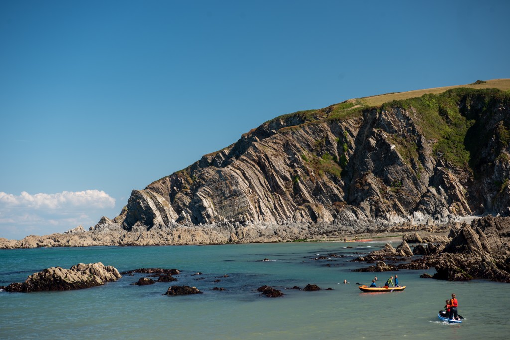
A beautiful bay hugged by soaring cliffs with numerous rock gullies and secluded coves for family adventures. Located between busy Ilfracombe and Woolacombe and once a haunt of smugglers, Lee Bay is tucked away at the end of a deep, wooded coombe dotted with picturesque stone cottages. Launch from the small sand beach that’s exposed at low tide in the main rocky cove. Head west (left) past Outer Appledore Rocks to reach Sandy Cove, or paddle east (right) to visit the otherwise inaccessible and sandy Broadoar Bay. Take snorkelling gear and on higher tides float over the rock shelves and look out for the wafting fingers of gem, beadlet, and snakelock anemones. Further out into the Bristol Channel, you may catch sight of dolphins. For a post-paddle treat, walk a short distance into the hamlet of Lee to enjoy a local beer and food in the old, wood-beamed inn. Or walk a little further uphill to enjoy a cuppa at the simple café in the old schoolhouse adjacent to the church. Check the book for how to get there, launching, hazards, pubs and cafes, and the best weather and sea conditions for the route, along with 25 more routes in Devon.
Lessons, hire, tours Active Escape, tel. 01271 320745
Walks nearby
Cool camping Ilfracombe Lee Meadow Farm Camping, Shaftsbborough Lane, Lee EX34 8FF; tel. 01271 879825
Why Lee Bay is a special blue space
Lee Bay is part of the North Devon Biosphere and Bideford to Foreland Point Marine Conservation Zone, important for honeycomb worm reefs which support anemones, snails, shore crabs and seaweeds. This site also protects a range of important and vulnerable species such as the pink sea-fan coral which is a slow-growing colony of tiny anemone-like animals and themselves home to other creatures including a sea slug and a rare anemone. Dogfish also attach their eggs to pink sea-fans, wrapping the long tendrils at the corners of the ‘Mermaid’s Purse’ eggcase around the sea-fan’s branches. Spiny lobster are also protected within this site.
To help protect these special places please support Devon Wildlife Trust and the National Trust.
Erme Estuary
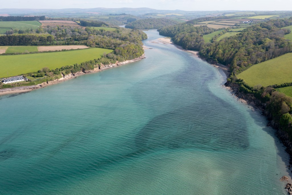
A 9.5km journey over shallow, crystal-clear estuary waters, past magical woods to the tidal limit of the River Erme. Launch from Mothecombe Beach, enclosed in a beautiful sheltered cove at the mouth of the estuary and one of the locations for films including Rebecca and Sense and Sensibility. In southwesterly winds there might be a little swell here, although it can be easily avoided by staying close to the shore. Pass beneath the Old Coast Guard Cottages, part of the Flete Estate, and gaze over at the sands of Wonwell Beach – an alternative launch point – on the opposite bank. After a short paddle past wooded banks, take the left channel where a large house with integral boathouse marks the fork in the river. The river now becomes increasingly narrow as it passes flooded lagoons where migratory birds gather. Enjoy glimpses of grand Flete House through the trees as you continue upstream, passing under a couple of footbridges before reaching the weir. Return the same way. Check the book for how to get there, launching, hazards, pubs and cafes, and the best weather and sea conditions for the route, along with 25 more routes in Devon.
Walks nearby
Cool camping Plymouth South Devon Wild Camping, Higher Meadow, Holbeton, Plymouth PL8, UK; tel; 07984 723387
Why is the Erme Estuary a special blue space
The whole route lies in the Erme Estuary Marine Conservation Zone which contains a wide variety of habitats from rocky shores to intertidal mud flats. These support a large number of important species including several that are rare, such as the nationally scarce tentacled lagoon worm. This is a tiny bristleworm which grows up to 5 mm in length and creates and lives in tubes within the mud habitats of the estuary. These worms have tentacles around their mouths used for gathering food from the surrounding muddy sediments. Estuaries play an important role in the environment, creating areas for wading and migratory birds to feed and rest and forming nurseries for juvenile species of fish. The large mudflats, gravel and rocks at low tide become foraging grounds for birds and crustaceans and at high tide they create shelter for juvenile species of fish. At the mouth of the river, mussels, limpets and barnacles cling to the rocks with patches of brown and red seaweeds growing in the crevices and on the landward side of the rocks.
To help protect these special places please support Devon Wildlife Trust and the National Trust.
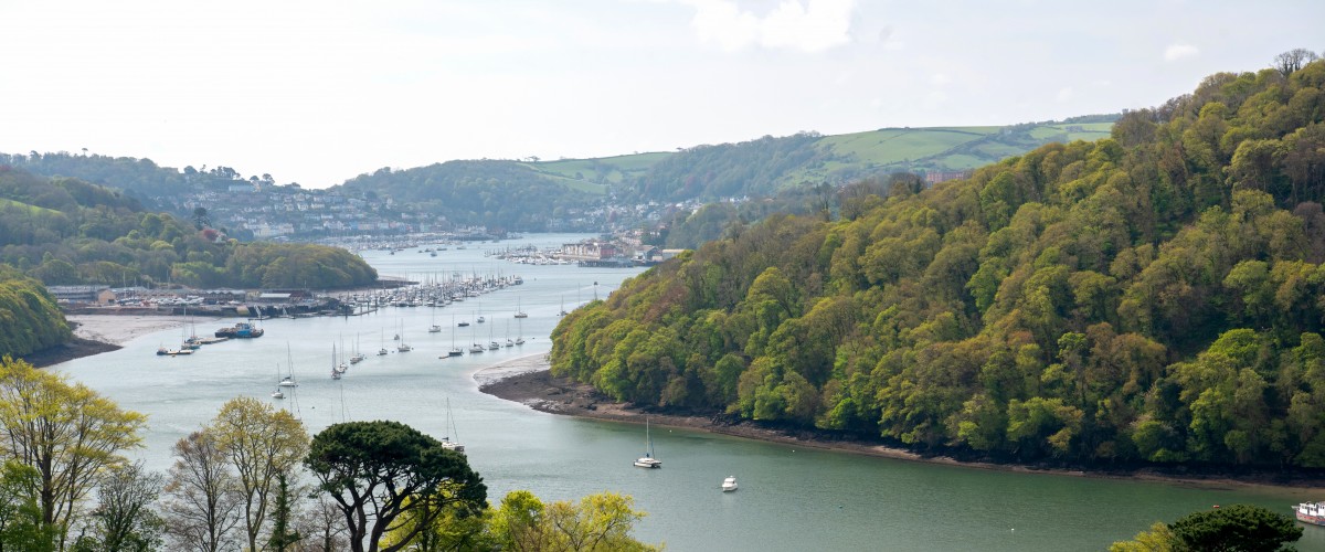
Totnes to Dartmouth
Launch from a historic market town and embark on this 15km (one way), winding tide-assisted paddle through the peaceful Dart valley to a bustling Naval port. Leaving the large slipway at Steamer Quay in Totnes, head downstream passing rolling hills, green fields, and woods. The Dart soon begins a series of sharp meanders and you’ll see rows of vines lining the hills of Sharpham Vineyards on the west (right) bank, then lovely Sharpham Wood. After another large sweep, the river starts to widen and Bow Creek joins from the right, followed on the left by Mill Creek, leading to the beautiful village of Stoke Gabriel – a lovely place to stop. Here the banks are overhung by oak trees and make idyllic picnic spots. Round the next meander the quaint village of Dittisham (right bank) comes into view and, directly opposite, is the quay and boathouse of Agatha Christie’s beloved Greenway. By contrast, a little further along the left bank notice the strikingly modern, glass-fronted boathouse at Maypool. The final stretch to Dartmouth along steep wooded banks is alive with birdsong and the occasional hoot of the steam train on its way to Paignton. Depending on tides, this route can be undertaken in either direction with an optional return by passenger boat or bus. Check the book for how to get there, launching, hazards, pubs and cafes, and the best weather and sea conditions for the route, along with 25 more routes in Devon.
Tours Canoe Adventures https://canoeadventures.co.uk/adventures/totnes-to-dartmouth , tel. 07706 343744; the Paddleshack, Dartmouth, tel. 07859 997126
Walks nearby
Cool camping Totnes Higher Broadgates Camping, Higher Broadgates, Cornworthy, Totnes TQ9 7HE; tel. 07547 705103
Why is the Dart Estuary a special blue space
The route is part of the Dart Estuary MCZ which supports a diverse array of habitats and species, including a number of rare species and as an important nursery ground for juvenile fish. Large areas of the intertidal mud provides feeding and resting grounds for wading and migratory birds. This is also an important habitat for the nationally scarce tentacled lagoon worm. This is a tiny bristleworm which grows up to 5 mm in length and creates and lives in tubes within the mud habitats of the estuary. These worms have tentacles around their mouths used for gathering food from the surrounding muddy sediments. The upper reaches of the route contains areas of saltmarshes and reed beds whichi provide a refuge for wading birds during high tide and storms and are home to a wide variety of worms, molluscs and crustaceans. Estuarine rocky habitats form in flooded river valleys or ‘rias’, such as the Dart, and provide a hard surface for animals and seaweeds to attach to in areas dominated by sandy and muddy environments. The seaweed species that attach themselves to the rocks form foraging areas for crustaceans (such as crabs) and birds at low tide as well as foraging areas and a refuge for juvenile fish at high tide.
To help protect these special places please support Devon Wildlife Trust and the National Trust.
Mountbatten to Bovisand
Explore caves, forts, and wooded cliffs at the eastern edge of Plymouth Sound after launching from the fortified Mount Batten peninsula on this 7km route. Strategically significant throughout history for protecting the port of Plymouth and controlling access to the River Plym, the peninsula was a wartime seaplane base where TE Lawrence (Lawrence of Arabia) was once stationed. Now a centre for watersports with a marina, there is a strong ocean-going vibe here. Head south towards the unmistakable clifftop bulk of Stadden Fort, battery, and the eye-catching wall, which looks more like an Arthur C Clarke-inspired installation than the remains of an 1860’s musket range. Paddle around Jennycliff Bay or simply sit and enjoy the views across the Sound to Drake’s Island as you watch the comings and goings in the shipping lanes. Continuing further south, the cliffs become densely wooded and a modern lighthouse roughly marks the journey’s halfway point. Beyond, where a small stream enters the bay, are various rocky inlets, fascinatingly folded rocks and small caves to discover. Pass the stone daymarks then directly below the radar on the hillside at Watchhouse Battery find the larger cave that is possible to paddle into at mid-tide. Round atmospheric Bovisand Pier and Fort to enter Bovisand Bay (a good spot for a dip) then walk uphill to the café. Return the same way. Check the book for how to get there, launching, hazards, pubs and cafes, and the best weather and sea conditions for the route, along with 25 more routes in Devon.
Lessons, tours Mountbatten Watersports and Activities Centre, tel. 01752 404567
Walks nearby
Cool camping Plymouth Drakes View Camping, Staddon Heights Golf Club, The White House, Plymouth PL9 9SP; tel. 07831 225440
Why is Plymouth Sound a special blue space
Plymouth Sound is the UK’s first National Marine Park and one of the world’s most important and visually stunning natural harbours. It has multiple designations for protected habitats and supports over 1000 species of fish and other marine animal life. It is home to HMNB Devonport, the largest naval base in Western Europe, commercial ports, a substantial national fishing fleet, international fish market, commercial diver training, a global hub for marine leisure industries and an internationally important marine research cluster. It is a historic tourist destination; Plymouth and its people have played a vital role in the development of Europe and the Americas.
To help protect these special places please support Devon Wildlife Trust and the National Trust.
Check out other top places to paddle UK
England
South west
Top 5 places to paddle in Cornwall
Top 5 places to paddle in Devon
Top 5 places to paddle in Dorset
Top 5 places to paddle in Somerset, Bristol and Bath
Top 5 islands to circumnavigate
South and east
Top 5 places places to paddle in the Channel Islands
Scotland
Top paddles on Scotland’s Islands
