No activities have been added for this island yet.
Oronsay Skye
Share via...
57.335693, -6.464605
About Us

Hi and welcome to Islandeering Islandeering is for people who want adventure in Britain’s wild blue spaces – our rivers, coast, lakes, canals and islands. You will find amazing walks, paddles and swims in the UK’s most special places, those recognised for outstanding natural beauty, incredible geology or special and abundant wildlife.
Learn More
Learn More
Distance: 6.9 km
Difficulty: Easy
Method: Walking
Wow Factor: 9 out of 10
Key Facts
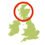
- Location: Near Isle of Skye
- Size: 18 hectares
- Terrain: Access to Ullinish Point can be boggy; most of the island route is on grassy cliffs
- Access: Tidal beach
- Height gain: 224 metres
- Map: OS Explorer 410
- Starting point: Car park along the lane leading south from the Ullinish loop road. Lat/Long 57.348267, -6.452557. GR NG 32252 37411
- Accommodation/food:
The closest shop and café is the Bog Myrtle at Struan with further shops and restaurants in Dunvegan. The closest campsite (tents and motorhomes) is near Dunvegan at the Kinloch Campsite https://kinloch-campsite.co.uk
- Island Summary:
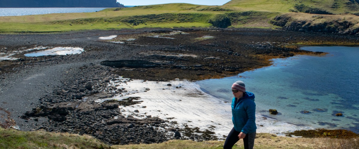
This short walk on the Isle of Skye is big on views, soaring cliffs, large sea caves and deep gullies. The walk follows a clearly marked path to Ullinish Point onto a pebbly causeway. Once on the island the easy free-range route uses the grassy cliff edges and provides plenty of opportunities to explore the impressive sea caves and gullies or to rummage around in the underwater world of several large rock-pools. For the energetic, the short sharp climb to the western tip is rewarded with a stunning panorama of the precipitous Talisker headland, the peaks of the Black Cuillin and the Old Man of Stor towards the north end of Skye.
- Look out for:
- Explore the cave and tunnel on the south shore
- Wild camping on the flat grassy area on the east side of the island
- Spectacular views of the Outer Hebrides, north Skye and Cuillins
- Chance to see golden eagles, otters, dolphins, gannets and more
- Route description:
The walk follows a clearly marked path to Ullinish Point and onto a pebbly causeway. Once on the island the easy free-range route uses the grassy cliff edges and provides plenty of opportunities to explore the impressive sea caves and gullies or to rummage around in the underwater world of several large rock-pools. For the energetic, the short sharp climb to the western tip is rewarded with a stunning panorama of the precipitous Talisker headland, the peaks of the Black Cuillin and the Old Man of Stor towards the north end of Skye.
- Getting there:
By car leave the Sligachan to Dunvegan road (A863) following signs to Ullinish. At the bottom of this loop road there is a lane leading towards the island with the footpath marker clearly visible. The car park is at the end of the lane. Bus 6100 from Portree to Dunvegan calls at the Ullinish House Hotel.
Island routes nearby:
Join our Islandeering community
We continuously find new islands, rivers, lochs, canals and coast to walk, SUP and swim in and meet plenty of great folks along the way. Join our community to get new routes and adventures, latest blogs and news by using the email box below. Tune in also to our Facebook and Instagram pages to see where we are going next.

Share via...
Gallery

Cliffs of Oronsay, Skye
Beachcombing on the pebble causeway to Oronsay
Sea caves on Oronsay, Isle of Skye