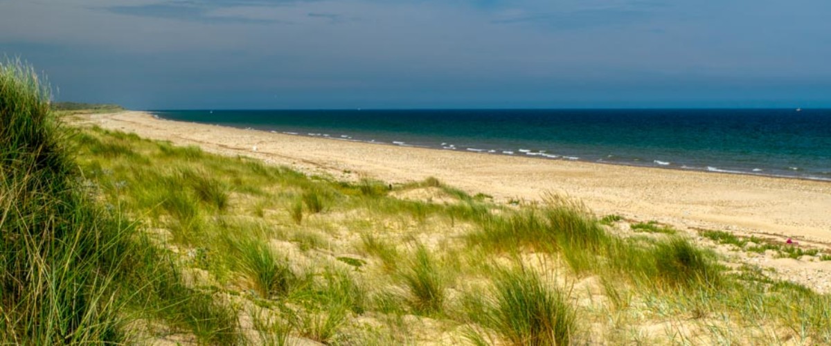
Scolt Head Island
Share via...
52.984663, 0.700457
About Us

Hi and welcome to Islandeering Islandeering is for people who want adventure in Britain’s wild blue spaces – our rivers, coast, lakes, canals and islands. You will find amazing walks, paddles and swims in the UK’s most special places, those recognised for outstanding natural beauty, incredible geology or special and abundant wildlife.
Learn More
Learn More
Distance: 15.2 km
Difficulty: Moderate
Method: Walking (and wading)
Wow Factor: 10 out of 10
Key Facts
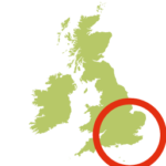
- Location: Norfolk
- Size: 700 hectares
- Terrain: Tidal sands, beach and coast path
- Access: Tidal creek crossing
- Height gain: 173 metres
- Map: OS Explorer 250 & 251
- Starting point: Burnham Overy Staith Quay GR TF 845 444
- Accommodation/food:
There are no facilities on Scolt Head Island. The closest are at Burnham Deepdale where there is an excellent café, campsite and Nisa store. The Hero pub at Burnham Overy Staithe serves good food and has rooms
- Island Summary:
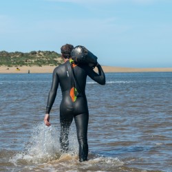
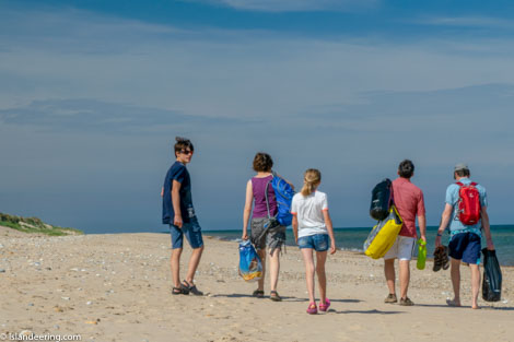
Scolt Head Island is owned by the National Trust and is a small paradise of sand dunes, salt marsh, mud flats, and shingle. It is internationally important for its birdlife (terns in particular which breed here). There are just two buildings on the island: one at the western end and the other more centrally situated towards the southwest end of the dunes. This is an adventurous walk that requires tidal crossings and good navigation skills. You need to cross two tidal creeks to get to the island, then cross two more to get back to the mainland. Many families simply cross Overy Cockle Strand at low tide, then spend a few hours on the island beach and walk back; or use the seasonal ferry from Burnham Overy Staithe to keep their feet dry (departs from the quay runs 1.5 hours before and after high water (daylight hours, Apr-Sept). Check times at boathouse (07836 523396).
Special notes: only attempt Norton Creek at low tide (passable 2 hours before/after). Beware of fast tides which flood E and ebb W in the creeks. Competent swimmers may swim back to the carpark only on a flooding tide. The carpark itself may flood on high tides. GPS thoroughly recommended.
- Look out for:
- Walking the extensive sands of the north shore
- Secret swimming in the warm pools of the creek and North Sea
- Spotting the incredible variety of birds
- Walking one of the best parts of the Norfolk Coast Path
- Route description:
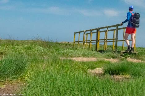
The circular walk of Scolt Head Island starts from the car park at Burnham Overy Staithe and crosses Overy Creek at low tide (or swim across at high tide). It continues through the beautiful salt marsh to Cockle Strand, which can be walked across at low tide. Once on the island the route follows the shore line in an anti-clockwise direction around the island’s east tip to reach its north shore. Walk for 4.4 km along the north shore until you reach a well-walked route through the dunes to The Hut. Continue on the path, marked near Butcher’s Beach on OS Maps, that skirts the western edge of Hut Marsh to reach the shore of Norton Creek. Cross Norton Creek +/- hours around low tide, then pick up the path through the muds and salt marsh for 1.2 km, to cross Mow Creek at lower tide. Continue on the obvious path that then intersects with the Peddars Way and Norfolk Coast Path at the coast. Turn left (east) along the coast path (or continue along the lane straight ahead of you to enjoy the café and shop). Return to Burnham Overy Staithe along the Norfolk Coast Path.
Special notes: Only attempt crossing Norton Creek at low tide (passable 2 hours before/after). Beware of fast tides which flood E and ebb W in the creeks. Car park may flood at high tides. GPS device recommended.
An alternative route wading and swimming along the sun-warmed creeks of the island’s south shore is described our book “Islandeering; adventures around the edge of Britain’s Hidden islands”
- Getting there:
At Burnham Overy Staithe turn off the A149 at The Hero public house into East Harbour Way. Turn right at the bottom of the street into a large area of flat ground where it is possible to park.
Getting to Scolt Head Island is a bit of an adventure. The island can be accessed on foot as described or buy seasonal ferry from the quay at Burnham Overy Staith. The times are posted on the door of the Boathouse. The ferry generally runs 1.5 hours before High Water to 1.5 hours after High Water during daylight hours between April and September. The ferry is operated by Mr Peter Bickell (tel. 07836 523396).
Whilst you are there why not try:
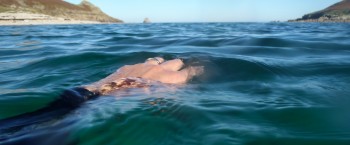
Wild swimming on Scolt Head Island
Check out our books
Find more blue space walks
Find an island adventure
Be the first to know about the latest adventures in wild blue space
Join our Islandeering community
We continuously find new islands, rivers, lochs, canals and coast to walk, SUP and swim in and meet plenty of great folks along the way. Join our community to get new routes and adventures, latest blogs and news by using the email box below. Tune in also to our Facebook and Instagram pages to see where we are going next.

Share via...
Gallery
Walking along the north shore of Scolt Head Island
Crossing the salt marsh to Scolt Head Island

Crossing Overy Cockle Strand at mid-tide