

The Turks Head, High Tide Seafood restaurant, two cafes and icecream at Troytown Farm with grocery at Post Office Stores. Several options for accommodation, including camping
The circular walk around the coast of St Agnes, Scilly, really does make you feel like you’re at the very tip of the British Isles. This truly is a walk on the outer edge placing you almost within touching distance of the fearsomely jagged western rocks and the swirling bird colonies of Annet. In the island’s south west, the only point between you and the three thousand miles of ocean to America, is the statuesque Bishop Rock lighthouse. The feeling of isolation is only enhanced by the wind-pruned heath of Wingletang Down and its bizarrely-shaped granite tors.
The coastal path around St Agnes starts at the Quay. It immediately passes The Bar to Gugh before taking in the heathery slopes around Wingletang Down and its fantastical granite outcrops, including Nags Head, on the rugged and wild west coast. Troytown campsite here’s plenty to see on the way and you don’t have to rough it – try the creamy Trotown ice cream and join in with a sea shanty or two as the beer flows at the famous Turk’s Head pub and farm provides a great opportunity for refreshments before a walk out to Burnt Island and then on around the north part of the island to return to the Quay. Download our free route and GPS (from the left hand bar)
How to get to St Agnes, Scilly – Inter-island ferry from St Mary’s
Other islands nearby:
St Mary’s | Tresco | Bryher | St Martin’s | Samson
We continuously find new islands, rivers, lochs, canals and coast to walk, SUP and swim in and meet plenty of great folks along the way. Join our community to get new routes and adventures, latest blogs and news by using the email box below. Tune in also to our Facebook and Instagram pages to see where we are going next.

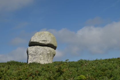
Devils Punchbowl – a granite formation on Wingletang Down overlooking Beady Pool Beach where allegedly you can still find beads from one of the many ship-wrecks around these shores
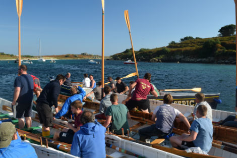
Gig-racing at the end of the season. The big race from St Mary’s, drink seven pints at the Turks Head, sing sea shanty’s and then race back. These guys are awesome. An unmissable event
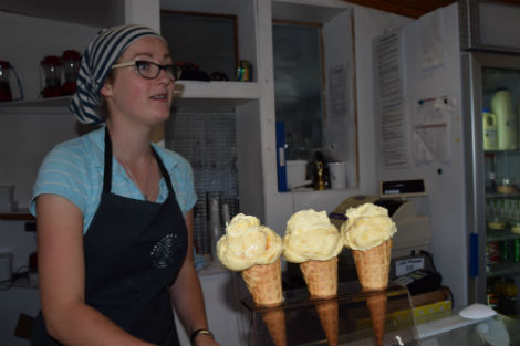
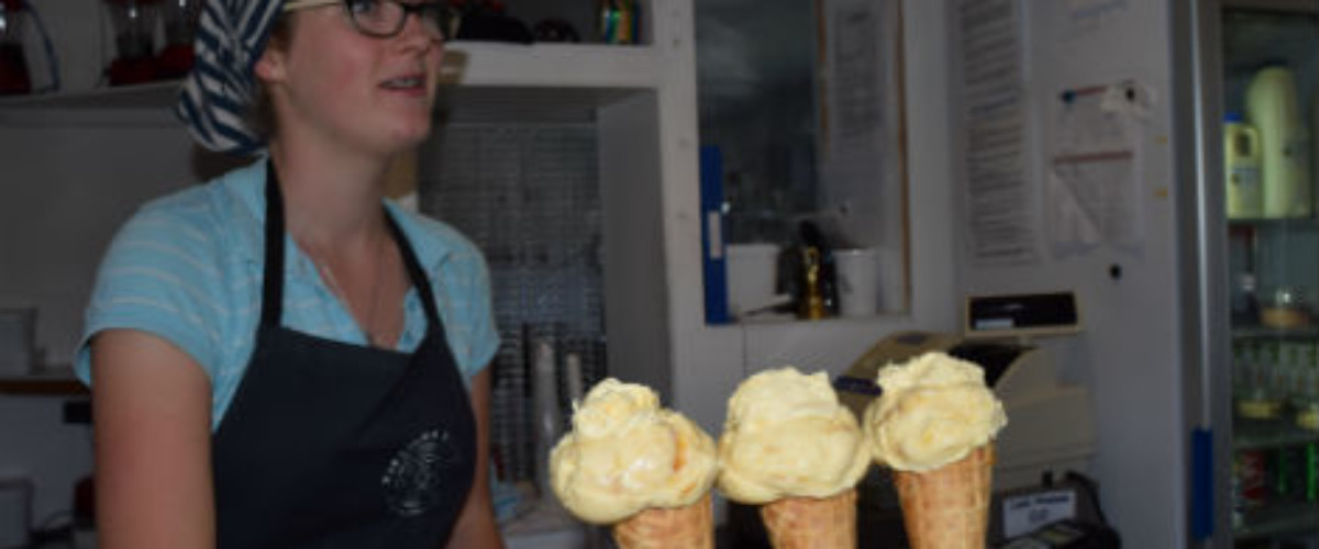
Oh so creamy Troytown Farm ice cream made by the smallest dairy in the country with just nine very special cows
