No activities have been added for this island yet.
Ynys Gifftan
Share via...
52.912352, -4.081522
About Us

Hi and welcome to Islandeering Islandeering is for people who want adventure in Britain’s wild blue spaces – our rivers, coast, lakes, canals and islands. You will find amazing walks, paddles and swims in the UK’s most special places, those recognised for outstanding natural beauty, incredible geology or special and abundant wildlife.
Learn More
Learn More
Distance: 4.5 km
Difficulty: Easy
Method: Walking
Wow Factor: 10 out of 10
Key Facts
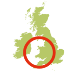
- Location: Gwynedd, North Wales
- Size: 7.3 hectares
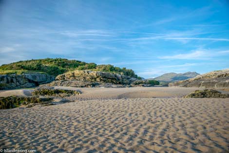
- Terrain: Saltmarsh, low-tide estuary sand
- Access: Tidal sands
- Height gain: 22 metres
- Map: OS Explorer OL18
- Starting point: Talsarnau station. Lat/Long 52.9047, -4.0677; GR SH 610 361
- Accommodation/food:
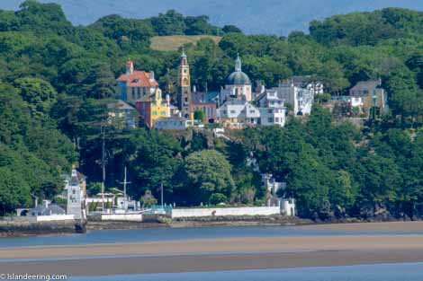
There is no accommodation on Ynys Giftan. There are three campsites close to Ynys Gifftan including Llech Camping; Tanforhesgan Caravan and Camping; and Barcdy Caravan Park and and Campsite Also, nearby, try the four-star Hotel Portmeirion ; or Edwardian Gwrach Ynys Country Guesthouse . The Ship Aground in Talsarnau is friendly and serves food; more facilities in Penrhyndeudraeth 3km away
- Island Summary:
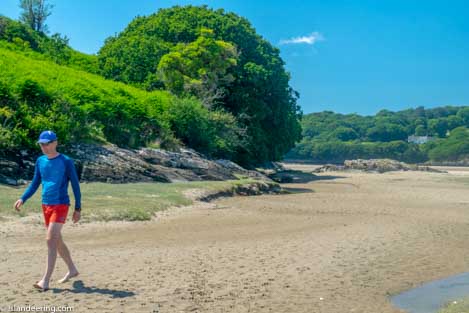
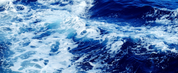
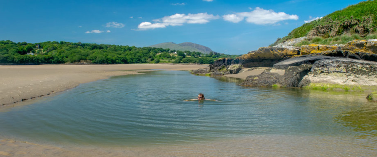
A fabulous tidal walk across the Dwyryd Estuary to reach this island that sits in the shadows of the mountains of Snowdonia and the spires of the Italianate village of Portmeirion. The walk crosses beautiful salt marsh and expansive tidal sands for the ultimate in wild swim in the sun-warmed pools. It is also possible to explore the beautiful foreshore of Ynys Gifftan. It is a great place to explore if you are walking the Wales Coast Path between Porthmadog and Harlech
- Look out for:
- Foraging for samphire in the saltmarsh
- Panoramic views of the majestic mountains of Snowdonia
- Heavenly picnic spots on the rocks
- Secret swims in the deep, warm pools
- Route description:
The walk to Ynys Giftan starts from Talsarnau railway station on the mainland. Head north-west on the track, then follow the obvious derelict fence line into the salt marsh. Navigate around the larger water-filled channels on dry land – or jump in and squash through the gloopy mud of the channel bottoms.
Cross the tidal sands to the rocks at the southern tip of the island. To walk around Ynys Giftan continue around the sands of the foreshore to the north tip of the island, then explore the ruins of the old farmhouse halfway down the east coast.
Access two hours either side of high tide: check BBC tide tables for Criccieth.
Full route details and more in “Islandeering: adventures around the edge of Britain’s hidden islands”
- Getting there:
Getting to Ynys Giftan. Take the A496 from Harlech, turning L at Talsarnau’s pub, the Ship Aground, and follow signs to the rail station to park. Trains from Porthmadog and Harlech on the Cambrian Line. Alternatively, you can access Ynys Giftan from the Wales Coast Path if you are walking between Porthmadog and Harlech. Follow the free downloadable route description to get to Ynys Gifftan
Whilst you are there why not also try:
A circular walk around Bardsey Island
Join our Islandeering community
We continuously find new islands, rivers, lochs, canals and coast to walk, SUP and swim in and meet plenty of great folks along the way. Join our community to get new routes and adventures, latest blogs and news by using the email box below. Tune in also to our Facebook and Instagram pages to see where we are going next.

Share via...
Gallery