
Skye-activity
Eilean Shona walking route
Key Facts
- Location: Loch Moidart, west coast Scotland.
- Size: 525 hectares
- Terrain: Steep, rough and through bracken on Shona Beag; tracks and well-marked paths, some of which can be boggy on Eileen Shona
- Access: Tidal crossing (or kayak from mainland pier at GR NM 661 712)
- Height gain: 890 metres
- Map: OS Explorer 390 Ardnamurchan
- Starting point: Layby south of Glenuig; grid ref. NM 673 744
Eilean Shona walk summary
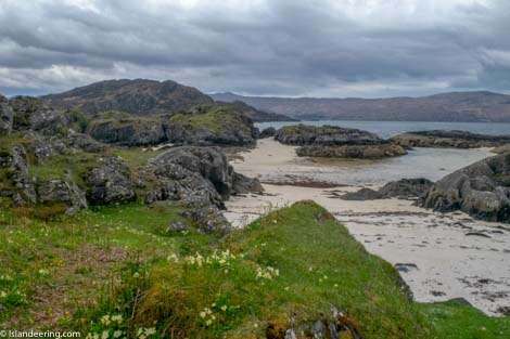
Eileen Shona is accessed via a short tidal crossing from the mainland to Shona Beag, a wild and remote peninsula to the east of the island. The free-range route across Shona Beag then reaches the isthmus that crosses to Eileen Shona. From here, the coastal path is reasonably well marked around the whole island. It passes the sublime scenery of the North Channel before heading inland and climbing alongside the charming Baramore Burn to a scenic saddle on the flanks of Beinn a’ Bhaillidh to reach the south coast.
Full route details can be found in our book ‘Islandeering: adventures around the edge of Britain’s hidden islands’; or download the route GPX below.
Special notes: Although a right to roam exists please respect the privacy of island guests. Call ahead (01967 431249) to let them know you are visiting or knock on the back door of Eileen Shona House or the woodman’s bungalow on arrival. To maximise time on the island start the walk just before the causeway floods to give yourself approx. 6.512 hours to explore. Crossing on the ebb allows less than 6 hours on the island before the next high tide.

Paddling out to Eilean Shona


Join our Islandeering community
We continuously find new islands, rivers, lochs, canals and coast to walk, SUP and swim in and meet plenty of great folks along the way. Join our community to get new routes and adventures, latest blogs and news by using the email box below. Tune in also to our Facebook and Instagram pages to see where we are going next.